A chilly Christmas week is ahead, with highs staying in the 40s on Monday and freezing rain possible on Christmas Eve morning.
Christmas Eve is a WRAL Weather Alert Day, with freezing rain possible early Tuesday morning. Brining trucks were out and about Monday, brining major highways, including I-40, I-540 and U.S. 1, according to the North Carolina Department of Transportation (NCDOT).
Other WRAL Top Stories
- Monday: Very cold and sunny. High in the mid 40s.
- Tuesday: WRAL Weather Alert Day with early freezing rain possible. High of 50.
- Wednesday: Partly cloudy skies. High of 54.
Chilly start to Christmas week
Clear skies and calm winds will collide with a frigid Monday morning, which started with lows in the 20s and the teens for some.
Monday will be mostly sunny with a high around 47 degrees.
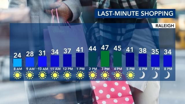
Late Monday, we'll see clouds increasing from the south thanks to a weak system forming along the coast.
WRAL Weather Alert Day for Christmas Eve
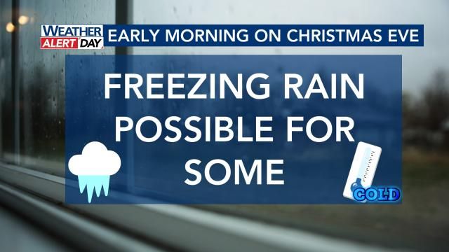
A Weather Alert Day has been issued for Christmas Eve, with freezing rain possible early Tuesday morning between 1 a.m. and 6 a.m.
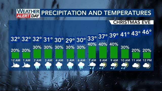
"Elevated surfaces could briefly become slick," said WRAL meteorologist Aimee Wilmoth. "By 7 a.m., temperatures should rise above 32 degrees, and it will just be plain rain."
Showers will be possible until lunchtime on Christmas Eve, and highs will top out around 50 degrees. Tuesday night will be partly cloudy and cold for Santa's big journey, and lows will drop into the mid 30s.
Staying seasonable, mainly dry by Christmas Day
We see a slight warm-up as the arctic air goes back up to the North Pole by Christmas Day.
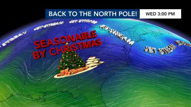
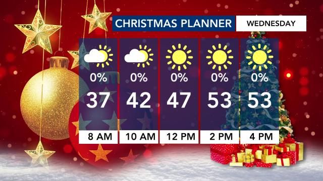
The morning starts out dry in the 30s, and the afternoon sees highs in the 50s. Most rain will hold off for Christmas Day, but we can't rule out a stray shower in our southern counties during the evening.
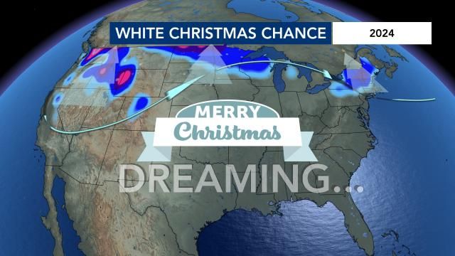
The best chance of a White Christmas will be well north of here - toward the Rockies, Cascades, Northern Plains and Great Lakes.
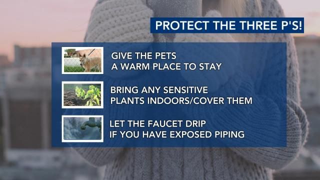
Protect pets, pipes, plants in cold weather
Don't leave house pets outside for long periods in the cold. Consider pet jackets or sweaters, especially if your pup has short fur. Be sure that any animal has access to an insulated escape from the cold.
Bring potted plants indoors, or even into the garage. Cover plants to prevent frost.
Check insulation for pipes, especially those in attics, basements and crawl spaces. Disconnect and bring in the garden hose to prevent it from freezing.
When will we see snow in the Triangle this year?
Historically speaking, a White Christmas happens 2% of the time in the Triangle, so it's already quite rare. Based on groups of forecast data (called 'ensembles'), there is a very very small chance of a White Christmas - 1%.
In fact, the snowfall outlook for the whole winter is not good. The WRAL Severe Weather Center is expecting just about one inch of snow all season.
We're likely to see La Nina conditions throughout the winter, and in La Nina years, storm tracks keep the cold to the north of North Carolina, resulting in below-normal snowfall and above-normal temperatures.
7-day forecast for central NC
- Monday: A mainly sunny sky. High 47.
- Christmas Eve: It's a WRAL Weather Alert Day. Showers and patchy freezing rain possible in the morning mainly east of the Triangle. High near 50.
- Christmas: Partly cloudy. Highs in the low-to-mid 50s.
- Thursday: More clouds with a stray shower. Highs in the 50s.
- Friday: A stray shower is possible. Highs in the 50s.
- Saturday: Considerable cloudiness with showers later on. High near 57.
- Sunday: Rain becoming more likely. High 60.
