Weather is rarely thought of as a romantic thing. That is, unless, you're talking about a White Christmas.
Maybe there was one you used to know, even if it were only in your dreams. Maybe you think back to watching the movie, when Bing Crosby tap danced with Danny Kaye.
Other WRAL Top Stories
What is a White Christmas?
Regardless, a White Christmas is a rarity in our part of North Carolina.
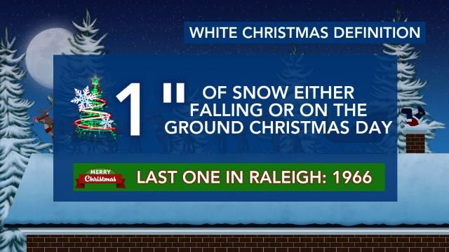
By definition (yes, there's a definition), a White Christmas is one in which there is one inch of snow on the ground or falling on Christmas Day. By that definition, the last White Christmas in Raleigh was in 1966.
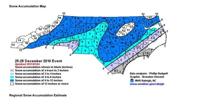
In 2010, however, we did get less than half-an-inch of snow Christmas Day. The following day, we saw nearly seven inches of snow in the Triangle.
I remember being with the NC State Power Sound of the South, having to board a flight to Orlando to play in the Champs Sports Bowl shortly after that storm!
Below is a map from the National Weather Service in Raleigh, showing the statewide snow totals from that storm. Again (for us), most of the snow we saw came the day after Christmas.
Historical odds of a White Christmas
As you can imagine, the odds of a White Christmas happening in North Carolina are almost entirely dependent on the varying terrain across the state. Historically, you get a White Christmas in Boone an average of once every five years. Those odds aren't too bad!
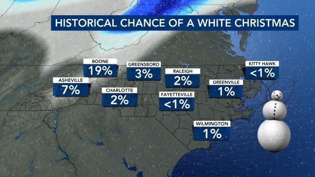
Odds from Fayetteville to the coast are 1% or less. *Insert "so you're saying there's a chance" joke from the movie, 'Dumb and Dumber' here.*
Let's broaden the view a little bit, and look across the U.S.
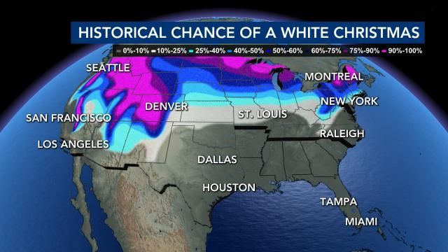
You don't have to travel terribly far for odds to go up above 50%. Booking a Christmas trip to Snowshoe, West Virginia gives you about a one-in-two chance of living out that dream of a White Christmas.
It's no surprise that the Rockies, Sierra Nevada and places along the US-Canada border have the highest odds.
Odds of a White Christmas in 2024
What about this year?
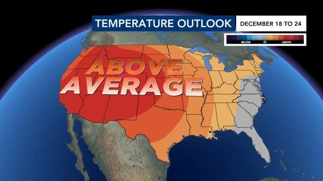
NOAA's Climate Prediction Center shows that warmer-than-average weather is likely across much of the U.S., though there's no definitive temperature trend locally.
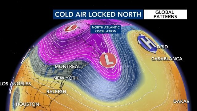
When looking at global weather patterns, I usually look at something called the North Atlantic Oscillation as a source for cold air. If the wind in the North Atlantic is lighter, colder air can escape its grip and drift farther south. However, if the wind is stronger in the North Atlantic, it essentially hugs the cold air tight and prevents it from crashing down into the Eastern U.S.
Early forecast data shows the wind in the North Atlantic being pretty strong, meaning that the odds of the cold air necessary for widespread snow is fairly low.
Of course, we're talking about patterns two weeks away. Check back for updates in the days leading up to Christmas, whether you're staying put or traveling.