Local News
Easley on Hanna: 'We dodged a bullet'
The governor warned residents Saturday, however, that flooding will continue to be a problem and to remain cautious.
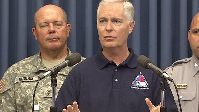
Posted — UpdatedRALEIGH, N.C. — As Tropical Storm Hanna accelerated toward New England Saturday after whipping winds and rain across the eastern part of the state, Gov. Mike Easley urged North Carolina residents to remain cautious and avoid areas flooded by the storm's rains.
"I think we dodged a bullet on Hanna," Easley said at a news conference Saturday afternoon. "But remember, it's not over until we get through with the flooding."
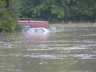
Easley warned that emergency management officials are expecting at least two major areas of flooding in the next several days.
The Little River, he said, is expected to crest at 28 feet at about 8 p.m. Saturday, affecting the area around East Manchester Road in Cumberland County. The Neuse River in Smithfield is expected to crest at 2 a.m. Monday.
"Although the storm is over, the flooding event is just beginning," Easley said, urging residents to stay put to stay safe.
He also warned the public to stay out of "dirty" floodwater that could contain snakes, bacteria and other dangers.
"Remember, this is where the injuries and fatalities occur – after the storm, when the flooding starts," he said. "If you want to see what happened during the storm, watch TV."
With top wind speeds about 60 mph, Tropical Storm Hanna made landfall Saturday morning in Brunswick County, downing trees and causing scattered power outages.
There were no major injuries and no reported fatalities, Easley said.
And although no major roads were closed, several rural roads did remain closed Saturday afternoon . A list of current road closures were available on the state Department of Transportation Web site.
About 75,000 outages were reported statewide, Easley said, and power had been restored to nearly half by Saturday afternoon. Utility companies expected power to be restored to all customers by midnight Saturday.
County and state emergency officials were still assessing storm damage, and full reports probably won't be available until later in the week. North Carolina will remain under a state of emergency until then, and at least until the water is gone, Easley said.
Emergency officials are also looking ahead to Hurricane Ike, a Category 3 hurricane with maximum sustained winds of 115 mph as of 2 p.m. Saturday. The storm's eye was about 135 miles east of Grand Turk Island in the Bahamas and was moving west-southwest about 15 mph.
Easley said it would be 36 to 48 hours before state officials have a clearer picture of how or if the storm will affect the state. One track has it moving toward North Carolina; another has it going into Florida and then on a path that could lead to the western part of the state.
"We don't know what the final track is," he said.
Copyright 2024 by WRAL.com and the Associated Press. All rights reserved. This material may not be published, broadcast, rewritten or redistributed.


