Golf course could be key to finding Lost Colony
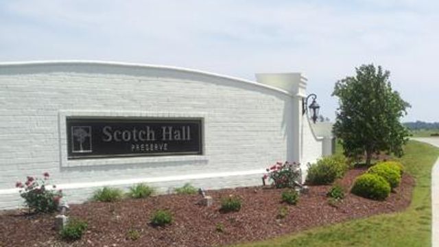
Scotch Hall Preserve in northeastern North Carolina is known by some to be a golfer's paradise, but it might be sitting on the answer to one of the state's oldest mysteries: What happened to the Lost Colony?
Posted — UpdatedBut it might be sitting on the answer to one of the state's oldest mysteries.
At a meeting Thursday at the University of North Carolina at Chapel Hill, researchers from the First Colony Foundation and the British Museum in London announced they found evidence on a 16th century map of Virginia and North Carolina that could answer questions about what happened to the Lost Colony.
Created by explorer John White in 1585, the map has two patches on it. One appears to correct a mistake, but the other hides what appears to be a fort.
Another symbol, appearing to be the very faint image of a different kind of fort, is drawn on the top of the patch. Scholars believe the fort symbol could indicate where the settlers, who disappeared from Roanoke Island in the late 1580s, went.
Aligned on a modern-day map of North Carolina, the spot coincides with Scotch Hall Preserve.
"We're excited," Bertie County resident Nancy Hughes said Friday. "I mean, this is big – huge.
Bertie County's economic development director, Steve Biggs, said there's actually about 1,200 acres that could be represented on the map.
"The map is not true to scale, so you can't tell exactly where it is," he said.
Because the land is privately owned, and because it's still unclear where to dig, it's unlikely that excavation would begin anytime soon.
But it doesn't have to, says Nicholas Luccketti, a professional archaeologist in Virginia and North Carolina for more than 35 years.
Archaeologists must first re-examine ceramics, including some recovered from an area in Bertie County called Salmon Creek.
Hughes found shards of pottery in that area spot about 15 years ago, she said. UNC researchers want to hear from others, like Hughes, who might have come across the artifacts.
"This clue is certainly the most significant in pointing where a search should continue," said Brent Lane, a member of the board of the First Colony Foundation, of the map.
White made the map and other drawings when he first traveled to Roanoke Island in 1585 on an expedition.
In 1587, he and 116 others settled on Roanoke Island.White returned to England for supplies, but couldn't return again until 1590 because of the war between England and Spain.
When he returned, the colony was gone.
The only clue he found about the fate of the other two dozen was the word "CROATOAN" carved into a post, leading historians to believe they moved south to live with American Indians on what's now Hatteras Island, but the discovery of the fort symbol offers the first new clue in centuries about what might have happened to the settlers.
Although the map was acquired by the British Museum in 1866, no one ever bothered to examine the patches until Lane wanted to know what was under them.
One corrected mistakes on the shoreline of the Pamlico River and the placing of some villages. But the other covered the possible fort symbol, which is visible only when the map is viewed in a light box.
The map was critical to Sir Walter Raleigh's quest to attract investors in his second colony and to convincing Queen Elizabeth I to let him keep his charter to establish a colony in the New World.
"If this was such an accurate map and it was so critical to their mission, why in the world did it have patches on it?" Lane said Thursday. "This important document was being shown to investors and royalty to document the success of this mission, and it had patches on it like a hand-me-down."
• Credits
Copyright 2024 by WRAL.com and the Associated Press. All rights reserved. This material may not be published, broadcast, rewritten or redistributed.


