Chance of light snow continues into Thursday
For the most part, the Triangle saw light rain Wednesday, but another disturbance in the upper atmosphere could bring snow flurries Thursday.
Posted — Updated
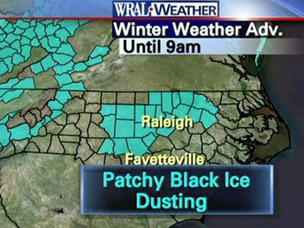
Scattered snow showers could fall in the Triangles and counties to the north, south and west. The best chance for seeing a snow dusting is between 7 a.m. and 10 a.m., and the chance will die out completely by late morning.
Those snow showers could produce a dusting in some places.
"There may be a flurry or two that flies. At this point, it's not going to be a big deal for us," WRAL meteorologist Elizabeth Gardner said.
Drivers should keep an eye out for black ice, particularly on bridges and overpasses, as temperatures drop to freezing by sunrise.
Black ice is a thin layer of ice formed from standing water on roads when temperatures drop below 32 degrees. It is almost impossible for drivers to see.
After the chance of snow passes, North Carolina will stay chilly.
"Temperatures are not really going to budge from where they are," Gardner said at 5 a.m. when it was 36 degrees in Raleigh.
Thursday will see highs around 39 degrees, and strong winds will make it feel colder.
"It's going to feel like the 20s for most of the day," Gardner said.


• Credits
Copyright 2024 by Capitol Broadcasting Company. All rights reserved. This material may not be published, broadcast, rewritten or redistributed.
 for 2024 season")


