Rain stays in forecast
A meandering cold front will keep the chances of rain showers and thunderstorms alive in North Carolina for the next few days.
Posted — UpdatedA severe thunderstorm watch is in effect for southeastern counties including, Cumberland, Edgecombe Johnston and Wilson, until 1 a.m.
WRAL chief meteorologist Greg Fishel said the storms were most likely to produce hail and damaging straight-line winds.
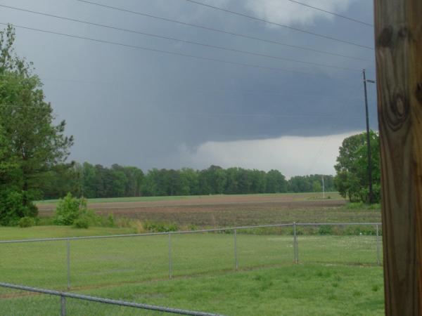
Hail was reported in Johnston, Wayne, Sampson, Lenior and Pitt counties. Possible funnel clouds were reported in Craven and Lenior counties.
The weather started to develop in the late afternoon and lasted into the evening as temperatures heated up into the low 80s.
The threat of thunderstorms should end by early Friday, WRAL meteorologist Mike Maze said.
A meandering cold front will keep the chances of rain showers and thunderstorms alive in North Carolina for the next few days.
"It doesn't look like our weather's going to quiet down really anytime soon. We just continue with this very same weather patten," WRAL meteorologist Elizabeth Gardner said.
Some sunshine poked through in the early afternoon after morning showers in the Triangle and heavier rain across eastern counties. But cumulus clouds were also developing – a sign that storms could also develop later in the day.
"On a day like this, we're looking at cumulus clouds growing and growing and growing, and eventually, you get enough activity in there that you get a thunderstorm," Gardner said. "We still have plenty of moisture that's streaming into the area, and that's going to fuel our instability."
The frontal boundary along which these storms are developing will hang around North Carolina and Virginia, creating the conditions for severe weather through the weekend.
"(The front) is going to wander a little bit over the next couple days, but it stays close enough to us that we've got the potential for showers and thunderstorms," Gardner said.
The front will migrate north some on Friday, lessening but not erasing the possibility for rain and storms. It will come closer again on Saturday and finally pass through the state overnight.
Behind it, North Carolina can look for cooler and drier weather next week.
What to do if you spot a funnel cloud
For those at home, the safest place is in a basement. If there is not one available, they should go into a hallway or closet.
The National Weather Service determined that an EF-2 tornado, packing winds between 125 and 130 mph, touched down at 4:50 p.m. on Tuesday on Rock Ridge School Road in Wilson County. It remained on the ground for about 2 miles.
Around 5:30 p.m., an EF-1 tornado, with winds between 70 and 95 mph, hit near N.C. Highways 42 and 96 in Johnston County. It traveled for 6 miles and then touched down again in a weaker form in Nash County.
Copyright 2024 by Capitol Broadcasting Company. All rights reserved. This material may not be published, broadcast, rewritten or redistributed.


