Meteorological spring began March 1.
By that definition, this has been the second-warmest spring on record in the Triangle (data since 1887) and the fifth-warmest in the Sandhills (data since 1910).
Other WRAL Top Stories
We're about to climb the ranks in the days ahead.
How hot are we getting?
According to our Monday morning forecast, we're going with highs at or above 90° in Raleigh from Wednesday through Saturday.
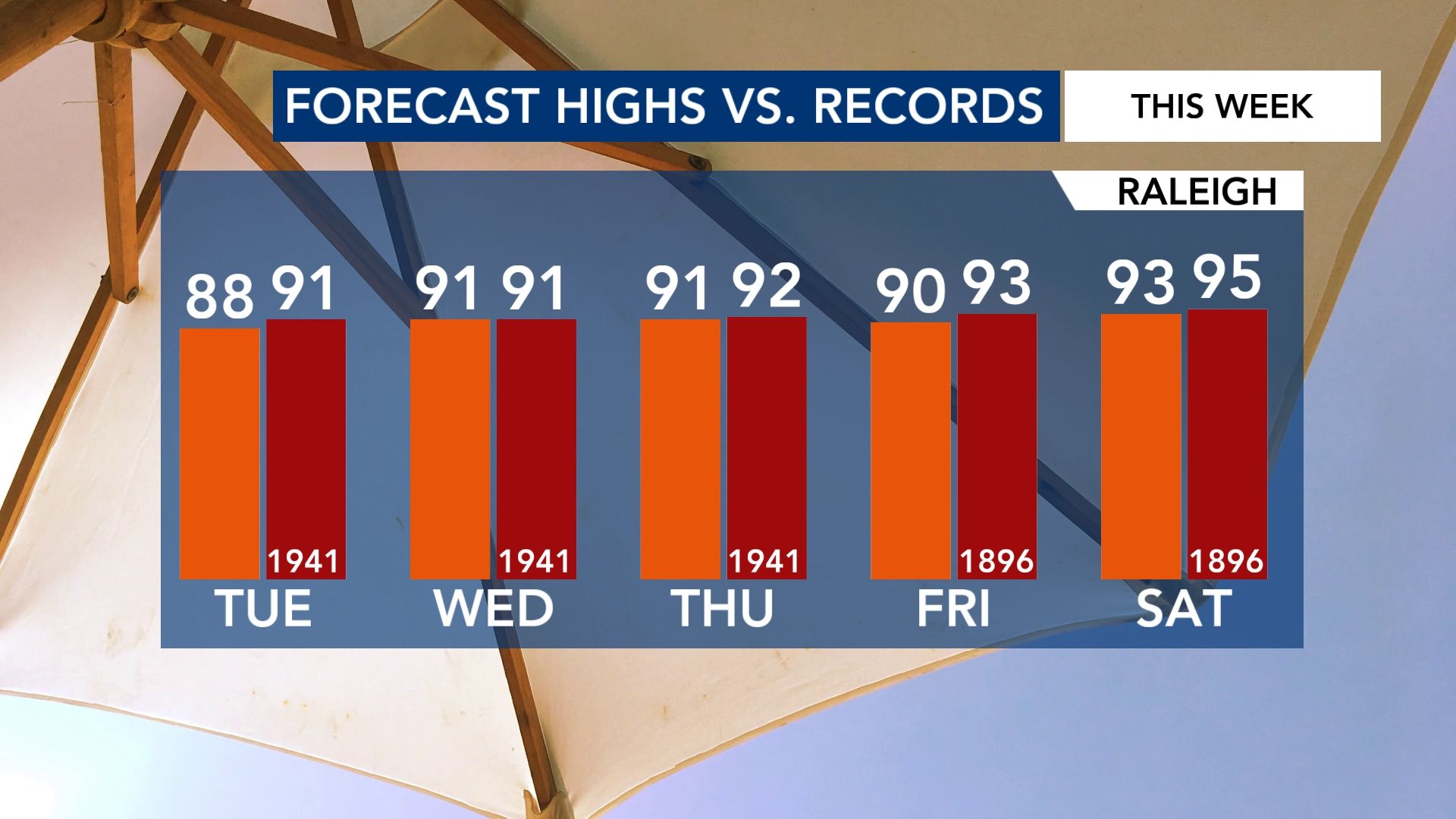
If this were June or July, you wouldn't bat an eye. However, this is April. A stretch like this is quite rare.
How rare is this early season heat wave?
As mentioned above, the weather records in the Raleigh area have been kept since 1887.
Since then, there have been 75 total days in the month of April that have hit (or exceeded) 90°.
That means 1.8% of sampled days have hit 90° in the month.
How about a four-day stretch in the 90s in the month of April?
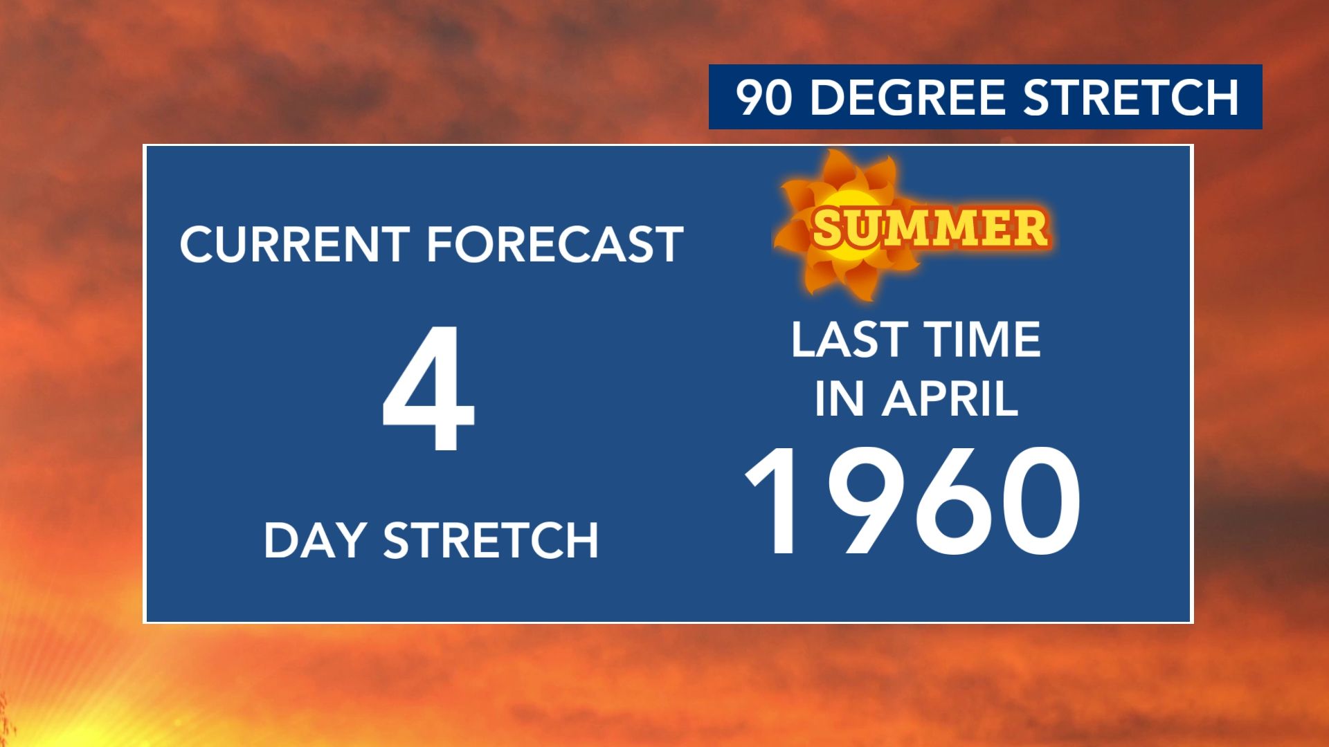
The last time that happened, Eisenhower was the President.
The Pirates would walk off the Yankees in the World Series months later.
The Super Bowl didn't exist.
And (fittingly), the song that topped the Billboard charts that spring was called "Theme From A Summer Place" by Percy Faith.
How does this upcoming heat wave compare?
I went back and dug up some archived weather maps from that stretch.
In late April of 1960, there was a large area of high pressure anchored over the Eastern U.S., while a storm system was getting going over the Rockies.
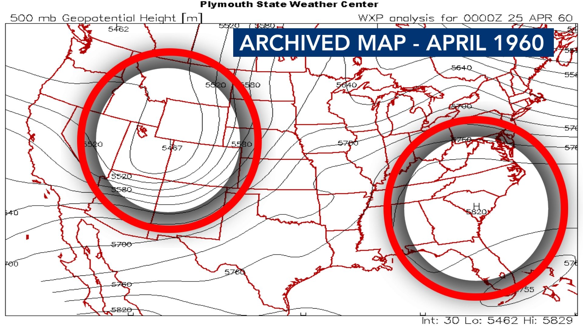
The sinking motion associated with the high - combined with the southwest flow around the Rockies' storm - both contributed to the long stretch of April heat.
Fast forward to the present day, and what do we see in the data?
The pattern is almost identical - strong high pressure over the Southeast and a storm system over the Rockies.
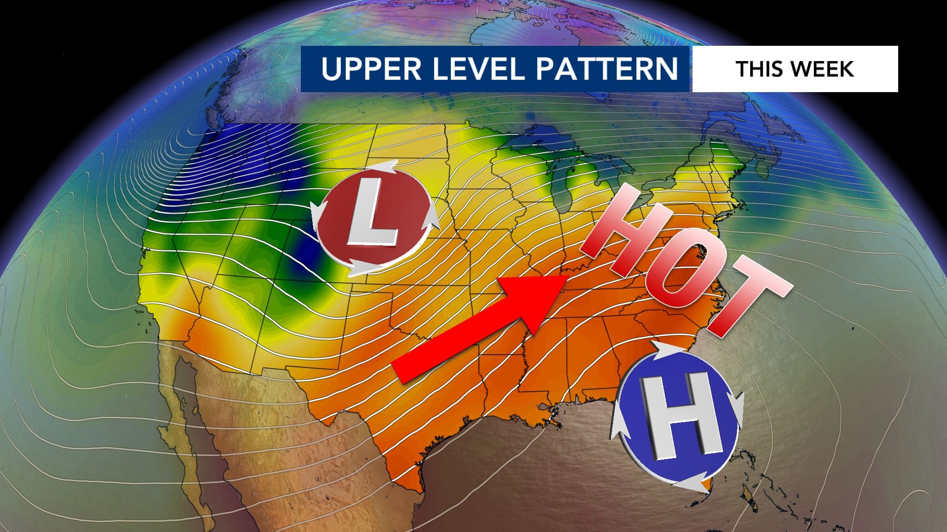
Other factors that could contribute to the heat this time around include the very dry ground (lack of evapotranspiration to cool the surface air) and increased development in the area.