Ida's remnants pass through, bringing showers Wednesday night
Remnants from Ida will bring rain and storms to central North Carolina beginning Wednesday afternoon.
Posted — UpdatedThe risk for severe weather in central North Carolina was downgraded to a Level 1 on Wednesday as showers moved through the area. Hit-or-miss storms are possible through the evening in the Triangle and temperatures remained muggy and warm.
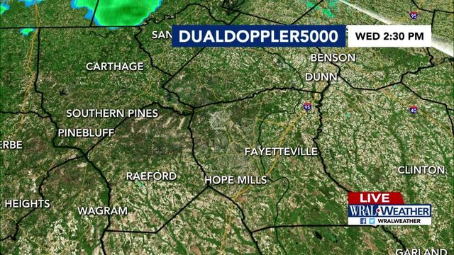
As of 8:30 p.m., the last band of rain and storms is weakening as it moves through the western part of our viewing area. Rain has arrived in Chapel Hill and Durham but the storms are mostly southwest of the Triangle.
Overall, the severe weather threat has decreased.
"One rain band we're really watching closely is moving through the viewing area right now, is moving through Raleigh and eastern Wake County, up into Granville County and Vance County," said WRAL meteorologist Kat Campbell. "The northeastern part of our viewing area still has an isolated chance of a severe storm this evening."
A band of showers and storms in the mountains is likely to move through tonight after dinner through sunset. It should weaken as it moves east.
While central North Carolina will receive less than 1 inch of rain, Ida's track means Pennsylvania and West Virginia could see excessive rainfall, as much as 5 to 7 inches of rain. Ida's remnants will reach the New England coastline by the end of the week.
In the Triangle on Wednesday afternoon, wind gusts above 30 mph and tornadoes will be possible but isolated. Much of the state is under a Level 2 risk for severe weather, and the chance for storms will increase throughout the afternoon.
Flooding is not expected to be an issue locally, as central North Carolina should see less than 1 inch of rain from Ida. The mountains saw between 2 and 3 inches of rain on Tuesday, much less than the devastating impacts caused by Fred last month.
Five water rescue teams, including two from Apex and Morrisville, deployed to western North Carolina on Tuesday in preparation of additional flooding. The risk for flooding dissipated on Wednesday afternoon, which is good news for communities already reeling from flood damage caused by Fred.
Ida battered Louisiana on Sunday, ripping roofs off homes and threatening flooding. The storm then wreaked havoc in Mississippi. As of Tuesday morning, four deaths have been blamed on Ida.
Tropical Storm Larry forms
Tropical Storm Larry formed Wednesday morning off the coast of Africa but is not expected to impact land.
Tropical Depression Kate, also not a threat to land, will continue to move northward over open waters in the central Atlantic.
Meteorologists are watching a low pressure system over the southwestern Caribbean Sea that has a slight chance of developing over the next couple of days as it moves to the west-northwest. Heavy rain possible is across Central America and the Yucatan Peninsula.
The peak of the Atlantic hurricane season is Sept. 10. Historically, mid-August through October is the most active period of the Atlantic season.
• Credits
Copyright 2024 by Capitol Broadcasting Company. All rights reserved. This material may not be published, broadcast, rewritten or redistributed.


