Relief. At least for some.
Thunderstorms came for certain parts of the Triangle and the WRAL viewing area on Saturday. Those who got the rain saw a drastic drop in temperatures as indicated by the graphic below.
Other WRAL Top Stories
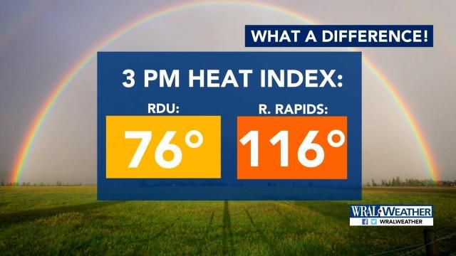
A severe thunderstorm warning for Wake, Chatham and Durham counties expired at 2 p.m. Saturday, but scattered storms were still possible throughout the evening, meteorologist Kat Campbell said. The National Weather Service said severe storms were located near Raleigh Durham International Airport and Pittsboro around 1:15 p.m. and included 60-mph gusts.

The storms brought a dip in temperatures on a day when highs were to reach 99 degrees. But central and eastern North Carolina was under an excessive heat warning from 10 a.m. Saturday to 6 a.m. Sunday. Heat index numbers were well into the triple digits in those locations and are expected to be that way again Sunday before relief is on the way with better chances of rain and temperatures in the 80s.
The last time an excessive heat warning was issued for the state was July 2017.

People should actively stay hydrated and make sure children, senior citizens and pets are safe this weekend, WRAL meteorologist Peta Sheerwood said.
A frontal boundary will move southeast early next week, bringing the possibility of up to 2 inches of rain on Tuesday.
Temperatures will drop, and the highs will stay in the mid-80s during the second half of next week, a relief from a two-week stretch of temperatures in the 90s.
