Cooler air spawns storms, flooding in Triangle
Air cooled by afternoon thunderstorms in North Carolina's southern counties rushed into the Triangle Monday evening, sparking showers and thunderstorms that brought cloud-to-ground lightning, heavy rains and straight-line winds.
Wake County dispatchers said flooding and downed trees were reported at Riley Hill and Rolesville roads in Wake Forest, as well as flooding on Rolesville Road between Fixitshop and Mitchell Mill roads. WRAL viewers also reported flooding in Lillington and Erwin.
More than 3,000 Duke Energy Progress customers in Wake County lost power during the storms.
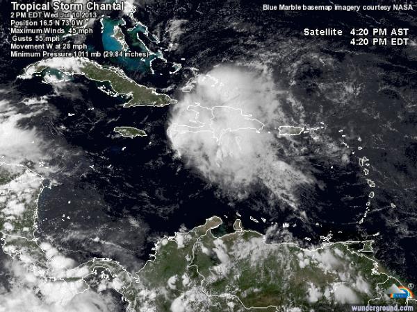
Meanwhile, Tropical Storm Chantal raced toward the Lesser Antilles after forming in the Atlantic, but WRAL meteorologists said it's too soon to tell whether North Carolina is in its path.
"There are no concrete indications that it will affect us," said Chief Meteorologist Greg Fishel. "It's still a long ways away."
The storm formed southwest of the island chain Sunday night to become the third named storm of the Atlantic hurricane season.
At 5 p.m. Monday, Chantal had maximum sustained winds of 45 mph and was moving west-northwest at 26 mph. The storm is about 2,400 miles southeast of Raleigh.


