Without 'red route,' feds to end funding for extending Wake toll road

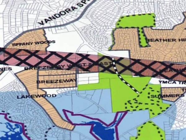
The Federal Highway Administration plans to withdraw funding for plans to extend the N.C. Highway 540 loop around Wake County because the state prohibits consideration of a controversial route for the highway through Garner.
Federal officials have given the North Carolina Turnpike Authority until May 19 to agree to conduct more environmental tests along the so-called "red route" or lose access to millions of dollars in federal funding for the project in the coming years.
The southeast portion of N.C. 540 would extend the Triangle Expressway toll road – currently under construction in southwest Wake County – and complete the loop highway.
State lawmakers voted overwhelmingly last year to block the state Department of Transportation from including the route in preliminary studies for the southeast extension of N.C. 540. Garner officials said the mere threat of a highway cutting through the middle of town was scaring off business and preventing people from buying and selling homes near the route.
The Turnpike Authority has said it wouldn't use the red route because of its adverse impact on 13 neighborhoods, a church and the town’s primary industrial recruitment area. But the DOT had to study the option because the Army Corps of Engineers requires that at least two proposed routes be studied before it will issue an environmental permit to allow highway construction to begin.
Federal transportation officials say they want data on what homes and businesses would have to move if the red route were used for the highway, as well as information on wetlands and streams along the route and an analysis of traffic, noise and other impacts.


