Fewer buildings, more vegetation along 'notorious' Crabtree Creek should limit flooding in the future
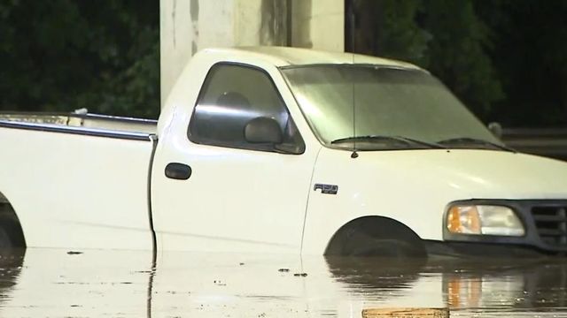
As Hurricane Ian moves north through Florida, residents of Wake County are worried about an area that consistently floods even from storms without names.
“Crabtree Creek is notorious for flooding,” said Five Points resident David Cornejo.
Crabtree Creek is a tributary of the Neuse River in central Wake County. It runs through the town of Cary and flows through Morrisville, William B. Umstead State Park, and the northern sections of Raleigh before emptying into the Neuse at Anderson Point Park.
Lake Lynn and Shelley Lake help to store some of water upstream.
“There is a big improvement from them, but they haven’t stopped it,” said city of Raleigh Stormwater Program Manager Wayne Miles said of the lakes.
Towering poles on the banks of Crabtree Creek shows how high water levels got during Hurricane Matthew in 2016.
“I am afraid to say it is always going to flood,” Miles said. “With climate change, these storms are coming more quickly, unfortunately.”
In July, Raleigh leaders tightened restrictions, preventing any new construction on floodplains. It comes after years of voluntary buyouts, in which the city purchased and demolished buildings along Capital Boulevard.
“If you put a building in a floodplain, it takes away storage from that floodwater and can make flooding downstream worse,” Miles said. “The water has got to go somewhere.”
Cornejo believes the city’s efforts to reduce building and add more vegetation in the floodplains are working.
“Honestly, it’s better than it has been in the past,” Cornejo said.
“Anything we can do to reduce the amount of runoff that goes straight into the pipes, straight into the creek is going to help mitigate the flooding events,” Miles said.
The city is investing in a pilot program to forecast flooding conditions before a storm. It consists of a network of rain gauges and cameras to help predict serious flooding hours before it happens. It will allow the city to notify the public quicker and close roads sooner.
The system will also allow city leaders to collect data and use technology to determine:
- When streams may flood
- How high floodwaters may get
- How much lead time the city has to prepare
- What resources are needed


