Hidden in plain sight: Remnants of Raleigh's historic streetcar system
You probably drive past remnants of Raleigh's old trolley system all the time, without even realizing it.
Posted — UpdatedYou probably drive past remnants of Raleigh's old trolley system all the time, without even realizing it.
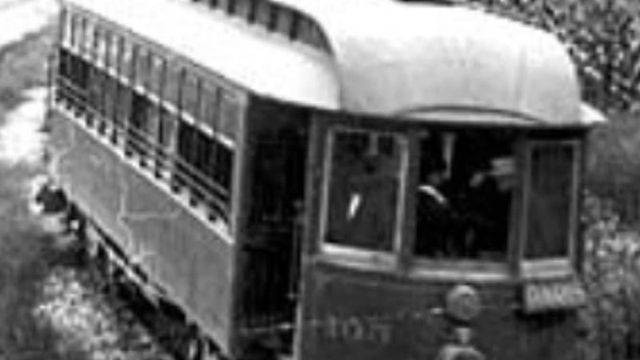
Before the rise of automobiles, our small capitol city boasted an electric trolley system – and before that, horse-drawn trolley cars. Trolley tracks ran down main streets like Glenwood Avenue, Hillsborough Street and Fayetteville Street. At the end of at least two trolley lines, magnificent trolley parks boasted electric lights, dance pavilions, carousels – and even a roller coaster.
Trolley lines were such a prominent means of public transportation only a century ago that remnants can be found around the city – such as pieces of track, trolley stops, stairwells and even a turntable – if you know where to look.
Even a small road named "The Circle" near Five Points is secretly a relic from the era of streetcars.
Raleigh's last remaining intact trolley stop
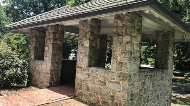
Many people don't realize the stone structure standing on Glenwood Avenue near Hayes-Barton was actually once a trolley stop.
Although many Raleighites have said they assumed this structure was a bus stop, this stone structure is one of the only remaining pieces of the trolley system. Details in the stonework date the structure as likely over a century old.
This was the final stop before Bloomsbury Park, which was the trolley park at the very end of the line. Trolley parks were popular in the early 1900s because they encouraged families to pay for trolley rides on the weekends.
Bloomsbury Park was boasted as 'metropolitan,' with thousands of electric lights, a carousel and a roller coaster. The carousel was bought by Pullen Park when Bloomsbury closed around 1920.
The park was mostly razed to make room for a new development; however, the historic neighborhood hides a few ruins from the century-old park – including the trolley turntable.
Bloomsbury Park's trolley platform and turn-around point
Overlaying a historic map of Bloomsbury Park over the modern-day map of the neighborhood reveals the location of multiple ruins: The stone pillars of the old dance pavilion and the concrete platform where the trolley once dropped off guests before turning around to head back down Glenwood Avenue.
Brick stairs leading to a flat concrete slab, overgrown with ivy and kudzu, is nearly unrecognizable in the front yard of an older home which was built over the remains of Bloomsbury Park.
Not only does the platform match up to the location shown on old maps, but it's just a few meters away from a street aptly named: Bloomsbury Park Drive.
This was the final trolley stop for the park: A platform where guests would step off to cross the bridge into Bloomsbury.
Trolley tracks hidden beneath Raleigh's streets
Maps of the trolley system show which roads held tracks back in the early 1900s.
Roads like Fayetteville Street, Glenwood Avenue and Hillsborough Street had tracks laid down. Several years ago, road construction on Glenwood Avenue revealed the antique tracks hidden beneath the asphalt.
Some Raleighites have shared rumors of trolley track visible on Hillsborough Street. While this has not been verified, it's definitely a possibility that a spur may have never been paved over.
Another Raleigh street connected to the old trolley system is 'The Circle.' This street is an oddly-shaped, very short loop road, with both ends connecting to Glenwood Avenue. Some have shared their curiosity about why a road like that would have been built – but historic documents revealed that The Circle was originally a turn around point for trolleys.
The Circle also sits very close to the remaining trolley stop on Glenwood Avenue, which was the last stop before reaching the park. It's easy to imagine the trolley turning around on The Circle, rather than going all the way to the park, on weekdays when people were traveling to and from work.
Related Topics
• Credits
Copyright 2024 by Capitol Broadcasting Company. All rights reserved. This material may not be published, broadcast, rewritten or redistributed.


