New maps get mixed municipal reviews
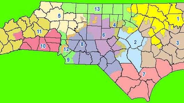
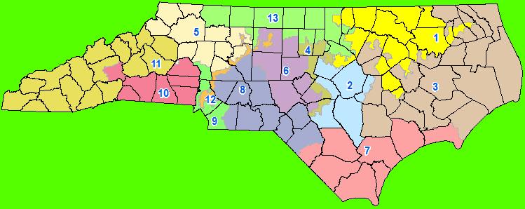
The legislature's proposed new congressional districts are getting mixed reviews from Wake County municipalities.
Posted — UpdatedThe legislature’s proposed new congressional districts are getting mixed reviews from Wake County towns.
The new map would slice the town of Garner down the middle, and Mayor Ronnie Williams isn’t happy about it.
“It appears to be political, and there’s no surprise there,” he said. “We think it’s a bit odd they would choose to split a relatively small town into two districts.”
Garner, which has a population of around 26,000, is mostly represented at present by 2nd district Republican Renee Ellmers.
Under the new map, 1st district Democrat G.K. Butterfield would represent the northern half of the town, and Ellmers would have the southern half. The line zigzags along blocks through neighborhoods, even picking up what looks like a strip of homes down one side of Highway 50.
“It’s tough enough with one member of Congress for a town our size to build a relationship and communicate with them. Now we’ll have to do it with two,” Williams said.
Republican leaders say there are advantages to having multiple congressmembers representing an area. Williams doesn’t agree. He says Ellmers also has Fayetteville, while Butterfield also has the coast. “The clout that they carry versus what we carry based on our demographics and the size of the town - we will lose out,” he said.
“We don’t see an upside to it,” Williams continued. “Everything we see is a downside. We don’t think neighbors on either side of a street should be in different districts. That’s silly. That’s almost stupid. That doesn’t make any sense.”
But other municipalities are more whole under the new map, not less – like Cary.
Under the old congressional map, most of Cary is represented by 4th district Democrat David Price. But the 13th district, held by Democrat Brad Miller, seesaws through the southern half of the town’s core like a staircase.
Hygh said the town council hasn’t taken a position on the new maps yet. “It hasn’t been discussed,” she explained.
But under the old map, Hygh said, it was often hard to know exactly which district any given neighborhood was in. “It’s difficult to tell, just looking at the big maps,” she said, “but this one looks a little bit clearer.”
Raleigh mayor Charles Meeker was unavailable for comment on the new map.
(And in the spirit of full disclosure, this reporter lives in Garner and used to live in Cary. Just so you know.)
Copyright 2024 by Capitol Broadcasting Company. All rights reserved. This material may not be published, broadcast, rewritten or redistributed.


