Local News
Tuesday Night Storms to Bring Strong Winds, Rain
An approaching cold front is expected to bring rain and possible thunderstorms across the Triangle.
Posted — Updated
An approaching cold front is expected to bring rain and possible thunderstorms across the Triangle Tuesday evening.
A low-pressure system will move over the North Carolina mountains Tuesday morning. Around 7 p.m., the system will start approaching the Triangle, bringing rain and cold, gusty winds.
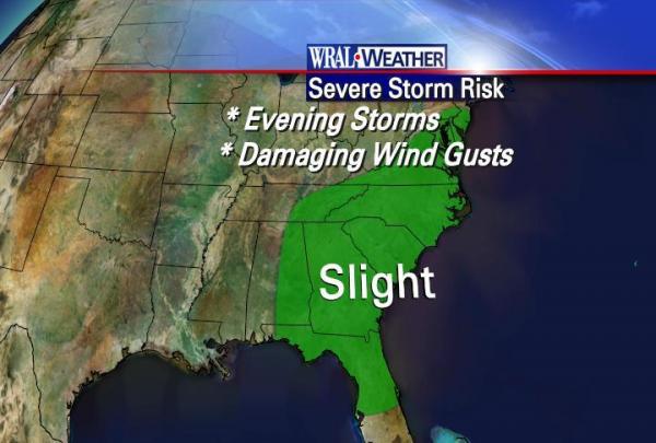
“There could be a brief but intense period of thunderstorms activity Tuesday evening (and) into early Wednesday,” WRAL Chief Meteorologist Greg Fishel said.
The main threat from the system is damaging wind gusts and perhaps an isolated tornado from 8 p.m. to 2 a.m.
The Triangle could see as much as an inch of rain. Temperatures will drop to the upper 40s.
Falls Lake, Raleigh's primary reservoir, remains close to 8 feet below normal levels. Officials said Friday it has enough drinking water to last at least through the end of June. Rain would help.
Meanwhile, Lake Michie, one of Durham's two reservoirs, has refilled enough to be 3½ feet below normal, and Jordan Lake is about a foot above what officials consider to be full.
Once the cold front passes, the weather will be mostly sunny and mild. Temperatures are expected to rise to the lower 60s Wednesday.
Thursday is expected to be partly cloudy, dry and mild, with highs in the mid-60s.
Friday, an area of low pressure will trek out of the Gulf of Mexico and move northeast up the Appalachians. The Triangle could see some decent rainfall from this system if it moves west of Raleigh, Fishel said.
• Credits
Copyright 2024 by Capitol Broadcasting Company. All rights reserved. This material may not be published, broadcast, rewritten or redistributed.


