The second you see "snow in Hawaii," you probably think, "What is going on?!"
However, snow on Hawaii's highest peaks is not that uncommon.
Other WRAL Top Stories
Winter visits the Aloha State this week
It's not like Hawaiians were walking the beaches and watching snow fall.
The Winter Storm Warnings that were previously in effect this week were for the volcanoes, Mauna Kea and Mauna Loa.
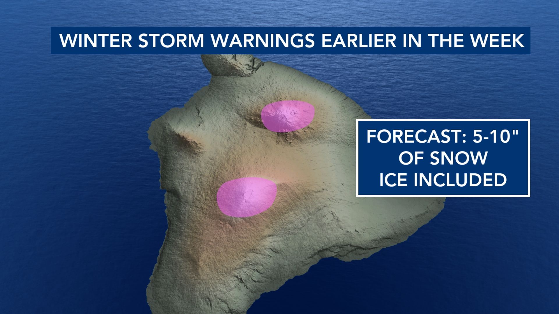
(Mauna Kea is pictured at the top of this story.)
If you're unfamiliar with the island's landscape, you might be surprised to know that these volcanoes reach peaks of more than 13,000 feet above sea level.
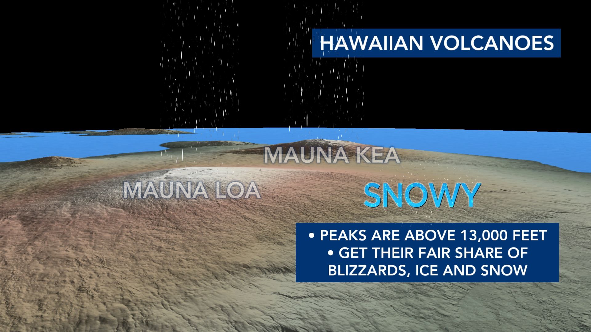
It's not to say that these peaks see snow with the frequency that the Sierra Nevada, Rockies, Cascades, etc. do. However, at an elevation that high, the air is going to be more primed for winter weather when storms arrive.
What causes the snow on top of these volcanoes?
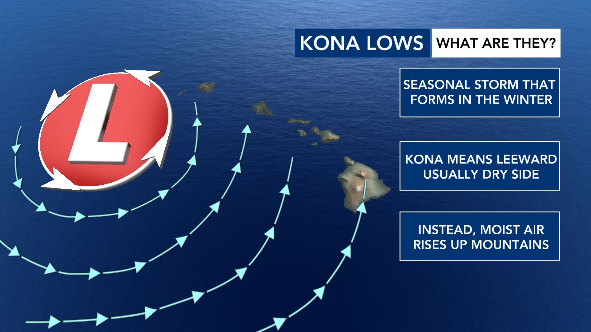
According to the National Weather Service, a seasonal low pressure system called a "Kona Low" is responsible for winter weather on Mauna Kea and Mauna Loa.
Kona means "leeward," which is the side of the mountain that is often void of precipitation.
However, when the moist air from the south and southeast rises up these mountains, it condenses and falls as precipitation.
Where does the Continental U.S. stand on snow?
WRAL News has an exclusive product in our graphics system - seasonal snowfall analyses. It shows the typical hot spots that include mountains and areas adjacent to the Great Lakes.
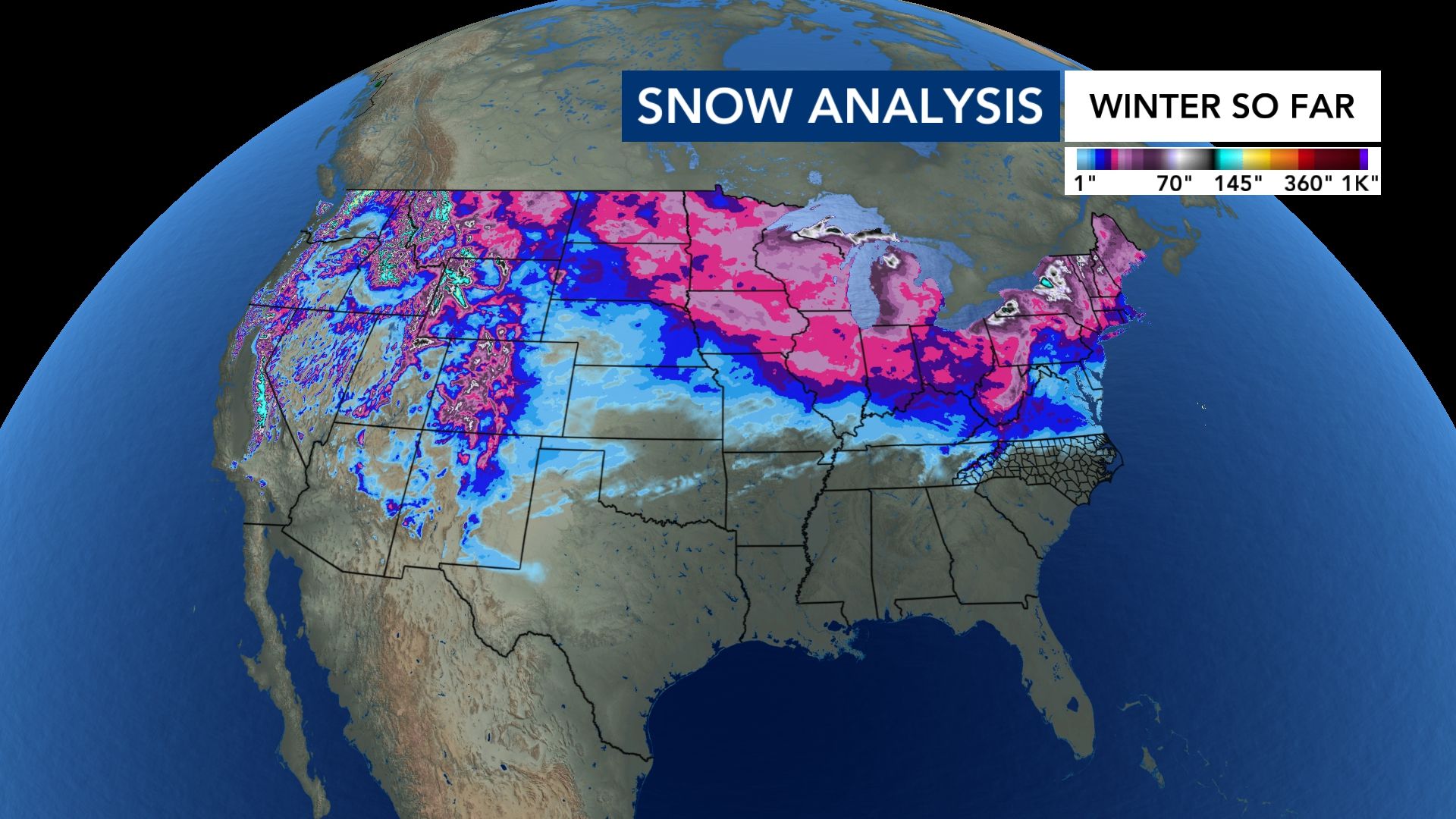
While we had a couple brief spurts of very light snow in December, we've been largely void of any good snow.
When you look at the average upper level air pattern the last month or so, you can see why.
The storm track has remained quite active in the Western U.S. and across the northern half of the country, while high pressure over the south has blocked any storm systems from diving down into the area.
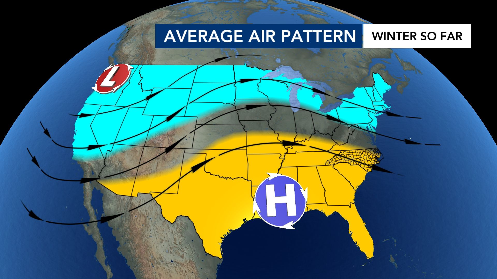
It's why 60% of North Carolina is currently in a drought.
Keep in mind that snow is also not as plentiful as it was in previous decades. We average 2-4" of snow per year in the last five-to-ten years. However, in previous decades, the Triangle averaged 5-7" of snow.
While we're very warm the next few days, the pattern does turn colder for us next week. Still, we don't see any favorable snow track just yet.
---
Have questions about the weather and how it works?
Send me an email with the subject line 'Ask the Meteorologist:' to cmichaels@wral.com.