House OKs new district map; Senate to follow
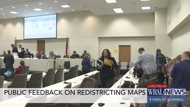
After criticism about a rushed process and accusations of partisan tweaking, the House approved a map of new voting districts Friday. The Senate is poised to follow suit with its own map Monday.
Posted — UpdatedOn Friday, following criticism about a rushed process and accusations of partisan tweaking, the House approved a map of new voting districts. The Senate is poised to follow suit with its own map Monday.
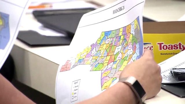
Voting maps have traditionally been drawn behind closed doors by outside consultants who use population data and sophisticated software to set district lines, but the judges ordered an unusually open mapping process, with all business done in public hearings.
"This is a better process than we've had in the past, but that is not a big hill to climb," said Jane Pinsky, director of the North Carolina Coalition for Lobbying & Government Reform.
Still, Pinsky was among several who criticized the rush to approve the House map, noting the final version wasn't publicly available until early Friday, which left little time for people with questions or concerns to have them addressed at a public comment period Friday morning.
"The people of North Carolina want you to let them have a voice in this process," Pinsky said.
"If you live in Asheville or live in Wilmington, there's no way you could have made it to Raleigh" for the 9:30 a.m. House committee hearing, said Rep. Deb Butler, D-New Hanover.
Republicans were irked by the push to slow the process, saying people had all week to weigh in on the proposed new districts.
"I believe some of these members, if they had the opportunity, they'd bring a camel and a clown in here so it would be a real circus, and they're trying to make it that," said Rep. Brenden Jones, R-Columbus. "Unless someone in North Carolina was living under a rock, they knew these public comments, the availability, these screens, these terminals, were here. So, I think it's time we wrap this up, talking about public comments that obviously have been sent out over the wire, TV, radio, the internet. Folks knew about it. It's time to wrap this up and move on with the people's business."
Jones' district was one of three in the cluster of Columbus, Pender and Robeson counties that sparked the most debate in the House. Republicans moved some precincts to ensure that Jones and Rep. Carson Smith, R-Pender, weren't in the same district under the new map, and Democrats called that and other moves to protect incumbents "heavy handed."
The was so much debate over the Columbus-Pender-Robeson grouping that the House, after giving preliminary approval to the full map by a 60-52 vote, split its final vote into two pieces. The rest of the map got a 68-42 vote, with eight Democrats joining the Republican majority, while the Columbus-Pender-Robeson section passed by only a 60-50 vote, with no Democrats voting for it.
After hearing criticisms about the short period for public review, House Redistricting Senior Chairman David Lewis said committee members would join a Senate public hearing planned for noon Monday and that any changes to the House map prompted by those comments could be handled during Senate votes on it.
Each chamber draws its own map, but each map has to be approved by both chambers. Under North Carolina's constitution, the legislature draws legislative and congressional district maps, and the governor cannot veto them.
The Senate is expected to vote on its map Monday night.
The judges in the case on Friday named Stanford University professor Nathaniel Persily as their referee in the case, saying he'll help the court determine whether the maps lawmakers approve can be used in next year's legislative elections. Persily previously helped redraw state maps in a separate federal lawsuit.
The 2020 elections are crucial. There's also a U.S. census next year, meaning the maps and North Carolina's congressional maps will be redrawn again in 2021 based on the new population count. The legislature elected next year, under the new maps ordered by the court, will handle that, and whichever party controls the General Assembly also controls that process, albeit with the constant threat of a lawsuit undoing their work, as it has for the Republican majority over and over again in the last half decade.
Related Topics
• Credits
Copyright 2024 by Capitol Broadcasting Company. All rights reserved. This material may not be published, broadcast, rewritten or redistributed.


