La Niña pattern could mean good news for snow lovers in WRAL's winter outlook
The winter months are almost here, so it's time for the WRAL Severe Weather Center's winter outlook.
Posted — UpdatedThe winter months are almost here, so it's time for the WRAL Severe Weather Center's winter outlook.
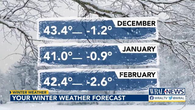
Above-normal temps, but snow still possible
Globally, temperatures tend to be below-normal during a La Niña pattern.
However, in the most recent nine La Niña years (out of the last 51), all but one saw above-normal temperatures in North Carolina during the winter months.
WRAL meteorologists are sticking with the odds and forecasting above-normal temperatures with a few cold snaps.
Data shows that in each La Niña year, there was at least one measurable snow event and at least three days with a trace of snow in addition to that.
For this year, WRAL meteorologists are predicting 2 to 5 inches of snow.
The outlier La Niña year
Last year turned out to be a fairly cold winter, with temperatures overall below-normal for December, January and February. Only 34 out of 90 days saw temperatures above normal.
The warmest high was 77 degrees on Feb. 28, and the coldest low was 20 degrees on Dec. 26 and Jan. 30. The all-time warmest winter high at RDU on record was 84 degrees on Feb. 26, 1977. The coldest was -9 degrees on Jan. 21, 1985.
Last year, WRAL meteorologists predicted 3 to 5 inches of snow, which would be short of the climatological normal of 6.8 inches. But, the prediction was a bit too optimistic, and central North Carolina only received a measly 1.2 inches of snow.
While it was a scanty snow year in central North Carolina, other parts of the United States saw record-breaking amounts of snow. In February, a massive winter system dumped snow across the northeast U.S.
Related Topics
• Credits
Copyright 2024 by Capitol Broadcasting Company. All rights reserved. This material may not be published, broadcast, rewritten or redistributed.


