Joaquin could strengthen, but don't expect a major impact in central NC
Tropical Storm Joaquin is expected to gain strength over the next several days, but an approaching cold front expected to stall over North and South Carolina will likely keep it from making landfall along the East Coast.
Posted — Updated
The tropical storm formed late Monday night in the Atlantic, becoming the 10th named storm of the season.
"The storm is very disorganized right now, and the convection around the storm isn't wrapped around the center," WRAL meteorologist Mike Maze said.
Maze said that the Triangle won't see any direct impact from Joaquin, but the area will see some tropical moisture over the weekend.
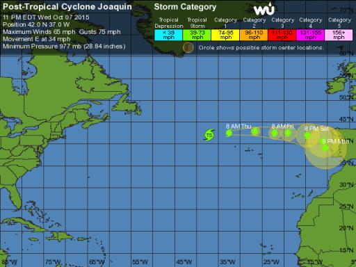
At 10 p.m. Tuesday, the storm was about 800 miles southeast of Raleigh and drifting west-southwest at about 5 mph. It has sustained winds of about 65 mph.
Maze said the storm is organizing and should be a hurricane by Thursday. By then, Joaquin will be moving north, parallel with the East Coast. It could have sustained winds of 85 to 90 mph when it passes off the North Carolina coast over the weekend.
"It's going to move up the coast, but it's really going to struggle to make landfall in North Carolina or elsewhere," he said. "A stalled front is essentially going to block Joaquin from getting to our area."
Maze said that it is possible that a cold front moving into the area could keep Joaquin away but tropical moisure from the storm could mean a few more days of rain.

• Credits
Copyright 2024 by Capitol Broadcasting Company. All rights reserved. This material may not be published, broadcast, rewritten or redistributed.


