From mountains to coast, NC folks no stranger to hurricane prep
We are still a couple of days out from the heavy rain and winds but officials say now is the time to prepare for Hurricane Ian.
Posted — UpdatedHurricane Ian made landfall early this afternoon. Both the Eastern and Western parts of North Carolina are now preparing for heavy rain, winds and possible flash flooding.
“It’s so recent and it’s so traumatic for a lot of people every time it rains or there is a flash flooding forecast people get nervous and rightfully so there’s still people near the river who are concerned about it,” said Allison Richmond with Haywood County EMS.
“That’s the perfect storm scenario we’re hoping that we don’t see," Richmond said. The river has been cleared out since then the debris piles and been removed we have everything in place to monitor that but somethings are just can’t know,”
Haywood County EMS says It currently has someone stationed upstream actively tracking river levels and ready to warn people down stream if there are any major changes. They are specifically looking out for landslides and downed trees.
“If it rolls over on top of us or if we have excessive amount of rainfall three-to-five inches, something we typically can handle," Richmond said. "When it starts to get higher than seven inches it’s very concerning. If it’s harder than that depends on the amount of time.”
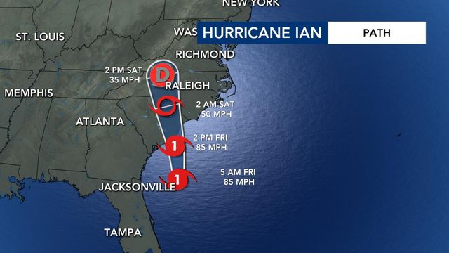
Over on the eastern part of the state, New Hanover County officials are keeping a close eye on Ian’s potential impacts. The county is expecting six-to-eight inches of rain with high winds Friday night into Saturday morning .
In Brunswick County, the emergency services director says they have crews on standby for potential flash flooding.
“We are between the Cape fear River and the South Carolina border," said Ed Conrow. "We have a significant amount of coast and our beaches face south which gives us a lot of exposure. Roadways can get flooded. Some low-lying areas, which we have a lot of, and we monitor any storm surge or title flooding for coastal towns and beach towns that we have,”
North Carolina is bracing for Ian on Friday. According to WRAL meteorologists, Ian will move quickly once it reaches land.
"It’s scary," Conrow said. "We don’t want storms to happen to anybody. We’ve had our fair share. It’s scary - the potential and the risk of loss of life and severe injuries and property damage. It’s going to be a long recovery for that area. It’s going to take a lot of time,”
Officials are also encouraging people to be ready for potential tornadoes Friday into Saturday morning and make sure you have your essential items in case of an emergency evacuation.
Related Topics
• Credits
Copyright 2024 by Capitol Broadcasting Company. All rights reserved. This material may not be published, broadcast, rewritten or redistributed.


