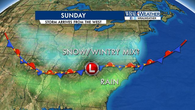
Maze: Too early to make a call on snow for Sunday
While the rest of the work week will featured plenty of sun and high temperatures around 70 degrees, a change is on the way for the weekend.
Posted — Updated"We are many days away," Maze said of a combination of conditions that could bring flakes to part of central North Carolina on Sunday. "It is too early to make a call."
While the rest of the work week will featured plenty of sun and high temperatures around 70 degrees, a change is on the way for the weekend.
A winter storm system spurred by high pressure over the Great Lakes will circulate cold air from Canada all the way into the Deep South by late Friday. Temperatures are forecast to dip from a daytime high of 70 to about 36 degrees late Friday night.
But the big question – snow, rain or nothing at all – won't be answered until early Sunday.
A low pressure area from the south will then move north through the Carolinas, and where it ends up will be the determining factor in the snow vs. rain battle.
"That low pressure brings plenty of moisture," Maze said. There is about a 60 percent chance for precipitation Saturday night through Sunday.
The path of the low will determine the line between snow to the north and chilly rain to the south.
Maze said that limited cold air and warm ground temperatures will make for limited accumulation if snow does fall.
"The ground temperatures will impede quick accumulation. Temperatures will be in the 40s," Maze said.
Snow in March is a rarity in the Triangle, but it has happened.
Only once since 1990 has more than an inch of snow accumulated after March 1, and that was in 2009.
• Credits
Copyright 2024 by Capitol Broadcasting Company. All rights reserved. This material may not be published, broadcast, rewritten or redistributed.


