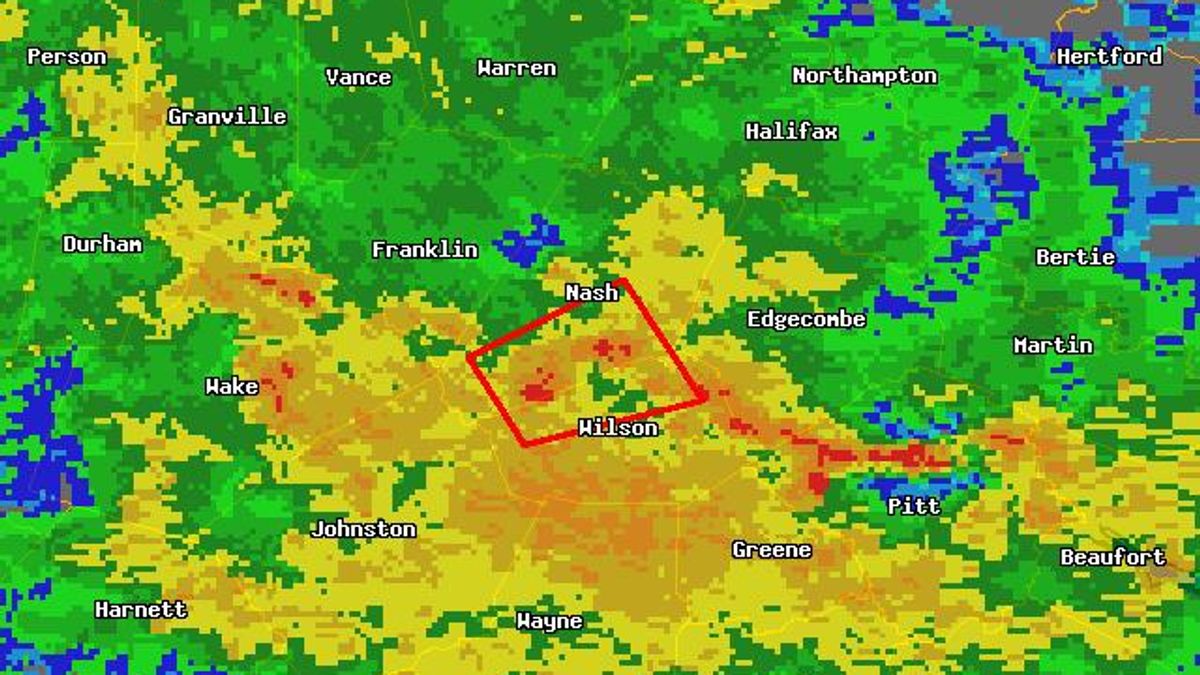
MIKE MOSS SAYS: Carrie, The tornado warning was issued for an area covering southern Nash and northern Wilson counties at about 10 pm based on radar observations of horizontal wind shear that indicates rotation. This rotation is not at the scale of a tornado, but rather a larger circulation within which tornadoes sometimes form. The area where a tornado appeared most possible was from around Bailey toward the east-northeast, but it's difficult to pin it down more specifically than that, and it is also possible that the cloud level rotation (sensed by the radar at about 1400-1600 feet above the ground) never did result in formation of a tornado or an actual touchdown. So far, no sightings (difficult at night) or damage reports have been received that would verify the occurence of a tornado in this instance.
Where exactly did those tonadoes in Nash Co. touch down at? I live in Bailey but I am close to Spring Hope as well. I'm more like in between Bailey and Spring Hope and I want to know what roads the tonadoes touched down at. I live about 2 miles from Southern Nash High School and it got very windy in this area and the rain was extremely heavy, so heavy that when i looked out my door i couldnt even see my front steps. Thank you so much!
null