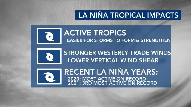
The National Oceanic and Atmospheric Administration expects a La Niña weather pattern to dominate in the Atlantic Ocean in 2024. A La Niña often means an active Atlantic hurricane season. 2020 was the most active season on record, and it was a La Niña year. Also, 2021 was the third-most active season on record and also a La Niña year.
What is La Niña weather? What is El Niño weather?
Other WRAL Top Stories
Through the spring of 2024, the east coast will be in an El Niño period, but it is weakening.
NOAA expects that La Niña could take over during the June-July-August time frame.
It's very common to have a quick transition from an El Niño to a La Niña.
The hurricane impacts of El Niño and its counterpart La Niña are like a see-saw.
El Niño means stronger hurricane activity in the Pacific, while La Niña indicates stronger hurricane activity in the Atlantic Ocean.
When meteorologists look at how busy a hurricane season is, two factors matter most: ocean temperatures in the Atlantic where storms spin up and need warm water for fuel, and whether there is a La Nina or El Nino, the natural and periodic cooling or warming of Pacific Ocean waters that changes weather patterns worldwide. A La Nina tends to turbocharge Atlantic storm activity while depressing storminess in the Pacific and an El Nino does the opposite.
“Hurricanes live off of warm ocean water,” said Colorado State University hurricane researcher Phil Klotzbach. “That tends to basically be fuel for the hurricane. But also when you have the warm Atlantic what that tends to do is also force more air up over the Atlantic, more rising motion, which helps support strong thunderstorms.”
During a La Niña pattern, WRAL meteorologist Kat Campbell says, "It's easier for storms to form and easier for them to strengthen. One of the reasons why is we have stronger westerly trade winds and that lowers the vertical wind shear."
La Nina usually reduces high-altitude winds that can decapitate hurricanes, and generally during a La Nina there's more instability or storminess in the atmosphere, which can seed hurricane development. Storms get their energy from hot water. Ocean waters have been record warm for 13 months in a row and a La Nina is forecast to arrive by mid to late summer. The current El Nino is dwindling and is expected to be gone within a month or so.
“We've never had a La Nina combined with ocean temperatures this warm in recorded history so that's a little ominous,” said University of Miami tropical meteorology researcher Brian McNoldy.
"It's not a guarantee that we will have a La Niña for the tropical season, but all signs are pointing in that direction," WRAL meteorologist Aimee Wilmoth said.
2024 hurricane season forecast
Early 2024 hurricane season forecasts from North Carolina State and Colorado State universities have also called for a great-than-average number of hurricanes.
How many named storms in 2024?
The average number of named storms from 1991 through 2020 in the Atlantic basin (including the east coast of the United States and the Gulf of Mexico) is 14.
NC State forecasters are expecting 15 to 20 named storms in 2024; Colorado State predicted as many as 23.
How many hurricanes in 2024?
Over the past 30 years, the Atlantic basin has seen an average seven hurricanes per season. In 2024, NC State and Colorado State both predict 10 to 12 hurricanes.
Of those, an average reach Category 3 – or major hurricane – status each year. NC State is forecasting three or four major hurricanes; Colorado State forecast five major hurricanes.
The Atlantic hurricane season runs from June 1 through Nov. 30. The Atlantic basin includes the entire Atlantic Ocean, the Gulf of Mexico and the Caribbean Sea.