Summertime in North Carolina typically involves heat, humidity and afternoon pop-up storms. While John Mayer may argue that "a little bit of summer is what the whole year is about," some of you may already be looking forward to fall.
Before we look ahead, I want to look back and review the back-and-forth weather we've seen so far this year. After seeing the second wettest winter on record at RDU, we flipped 180° and saw the driest spring on record.
Other WRAL Top Stories
Why Raleigh-Durham International Airport? RDU is a climatological site with daily records dating back to 1887. That data is used to derive our climate “normals,” including daily, monthly and seasonal temperatures and precipitation totals.
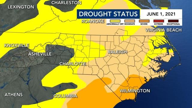
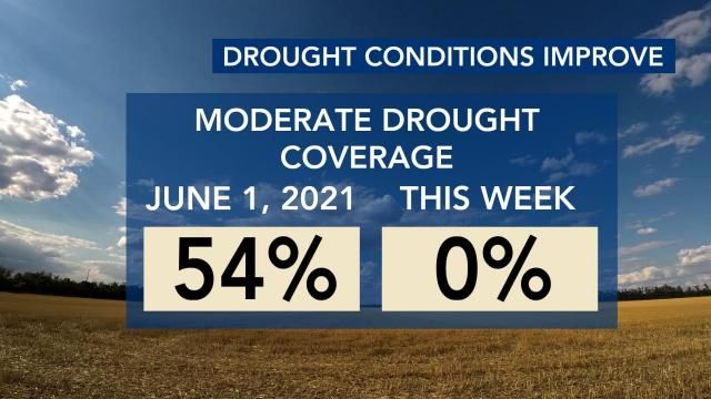
While seeing the driest spring on record with only 5.02” of rain, a deficit of 5.39”, drought conditions quickly ramped up. At the short-term drought’s peak on June 1, 83% of North Carolina was considered abnormally dry with 54% in a moderate drought.
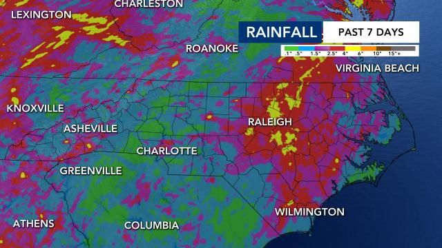
Since June 1, our area has seen quite a bit of rain. From typical summertime soakers to tropical rains from Claudette and Elsa, most communities are no longer in a drought. In the past seven days alone, much of central North Carolina picked up 3 to 5 inches of rain.
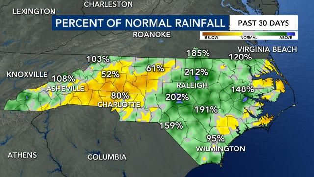
In comparison to our percent of normal rainfall we see over the last 30 days, most of our area has seen upwards of double (200%) the normal amount while the Triad and communities in the Foothills have seen nearly half (50%) the normal amount. As you may assume, that stark difference from east to west is primarily due to the track and rain from Tropical Storm Elsa.
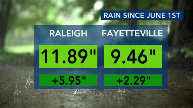
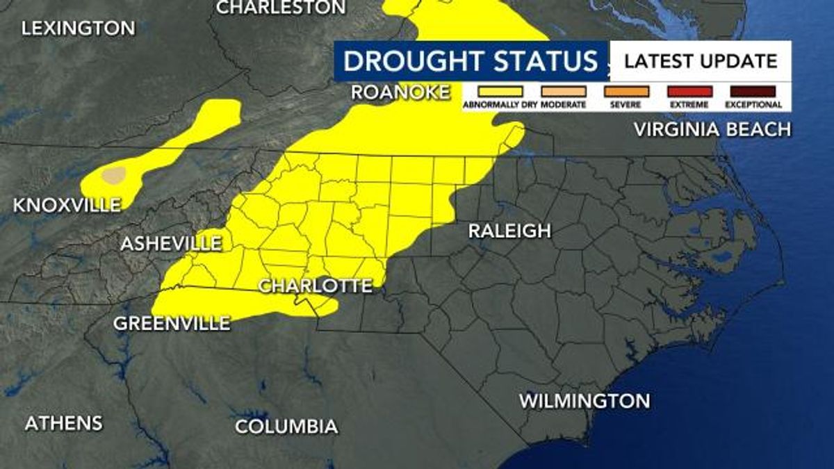
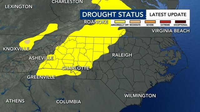
With all the rain we have seen since June 1 it is no wonder why the latest drought monitor update, released Thursday at 8:30 a.m., is a big improvement since the drought’s peak.
In just over seven months, we went from the second wettest winter on record to seeing the driest spring on record. We reached out to Dr. Kathie Dello, North Carolina’s state climatologist, for her thoughts on the past seven months and she said "it sure is climate whiplash!"
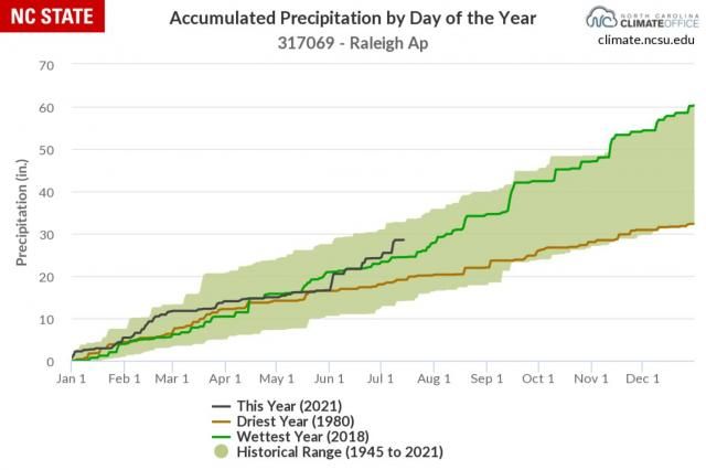
She went on to mention that "this year is already trending above the wettest year (2018) because our summer flipped back to being wet."
In regards to our going from one extreme to the next, Dello added that "our dominant trend is toward wetter overall, with flash droughts sneaking in. We also saw something similar in fall of 2019."
As we continue through summer and as some of you look towards fall, we will continue to see those pop-up showers add to our weekly rainfall totals. We may even see additional rain if tropical systems continue to come our way – we have seen impacts from two already.
No matter when and how the rain arrives, you can turn to WRAL’s Severe Weather Team to always show you the most accurate forecast. You can find their forecast on the WRAL Weather app and, of course, on WRAL News.