The models are getting more certain about the wintry weather headed to central North Carolina this weekend.
In a Wednesday evening update, both American and European models agreed that the Triangle is likely to see an inch or more of snow and some cold rain, although the timing and the specific amounts is still very much in flux.
Other WRAL Top Stories
"This system coming this weekend is going to have an abundant amount of moisture to work with, so, if it were to be in the frozen form it could actually be a pretty important event," said WRAL Chief Meteorologist Greg Fishel.

A series of increasingly colder days on Thursday, Friday and Saturday will set up the conditions for frozen precipitation later in the weekend.
In the Triangle, Wednesday night will see temperatures dip into the 20s. Thursday and Friday will be cold but clear and sunny with highs in the mid- to upper 40s.
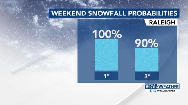
Although the system is still in California, the European Model shows there is an 100 percent chance of Raleigh seeing at least 1 inch of snow. The same model shows a 90 percent chance of the Triangle seeing 3 inches of snow.
"Now, this could be one of those things where most of the accumulation is on the grass and not necessarily on the roads," Fishel said.
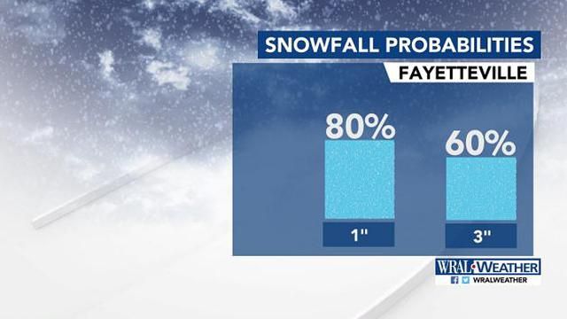
In Roxboro, the European Model shows there is a 100 percent chance of seeing 1 inch of snow. The chances are slightly less in Fayetteville, with only an 80 percent chance.
"There is definitely something on the way," Fishel said.