It’s no surprise that the tropics are starting to get a bit more active.
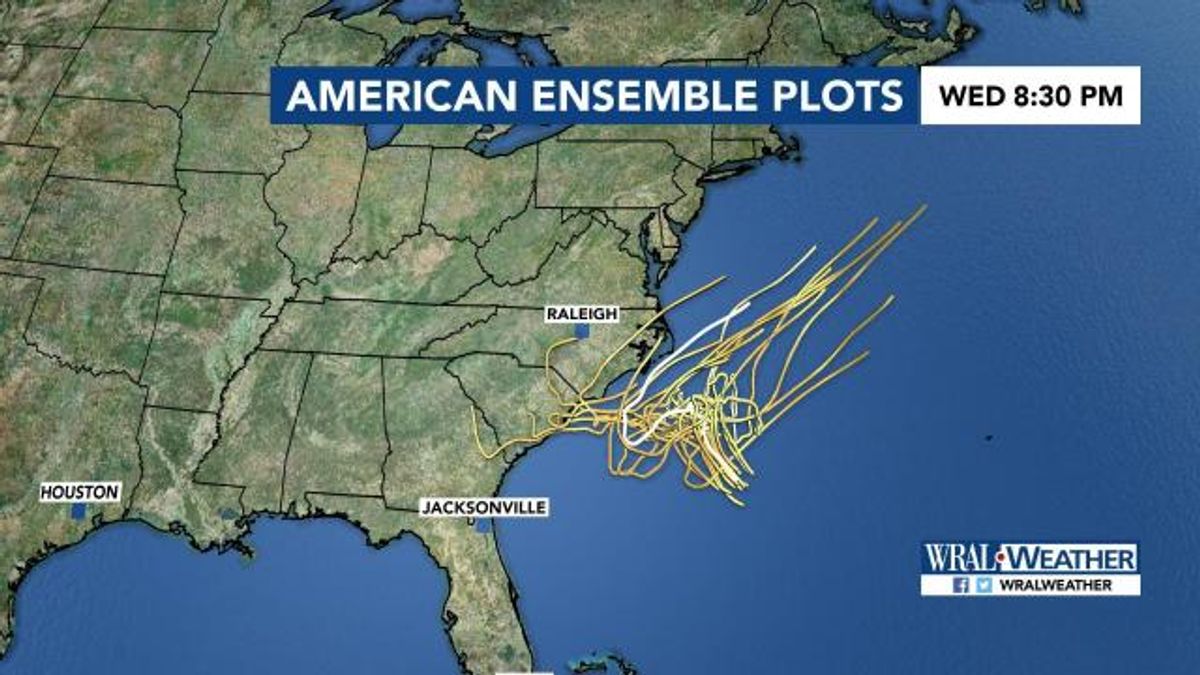
We will continue to monitor Hurricane Beryl, but our focus has shifted closer to home. There is a system a few hundred miles off the southeast coast of North Carolina and, even if it doesn't’ move over the state, there will be effects up and down our coastline.
Other WRAL Top Stories
For now, the system will wander about and stay offshore thanks to a cold front moving in late Friday night. If you are headed to the coast soon, be careful in the water.
Rip currents are likely to get stronger and the surf will likely be on the rough side heading into the weekend.
As we get closer to Wednesday, it’s possible it could brush the North Carolina coast. Details on how strong the winds could be at that point are yet to be determined, but showers and storms will likely become more common along the coast as we head toward the middle of the week.
If this system gets a name, it would be Chris! Stay tuned.