After a 'messy' Tuesday, Irma's rain, winds moving out of the area
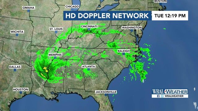
Irma weakened to a tropical depression on Monday night, and its bands of wind and rain are expected to move out of the area completely on Tuesday.
Posted — UpdatedThe threat for severe weather from Irma in central North Carolina remains very minimal, according to WRAL meteorologist Elizabeth Gardner, and the rain that moved into the area late Monday will stick around for much of Tuesday before diminishing for Wednesday.
Tuesday will be mostly cloudy and windy with bands of showers, especially morning to midday. Temperatures will be much warmer than Monday, with highs in the mid to upper 70s, and winds that could gust to around 15 to 25 mph early should diminish throughout the day.
The western portion of the state will be more affected than the Triangle, with 2 to 8 inches of rain and wind gusts from 40 to 70 mph expected.
During a news conference on Monday afternoon, Gov. Roy Cooper said the state remains ready.
"We’re grateful that the brunt of the storm will miss us," he said. “Things are looking better for North Carolina, but we’re not out of the woods yet and we don’t want any surprises.”
Once the effects of the storm move away, sunshine will return Wednesday. Highs will be much warmer, in the mid-80s, and only a small chance for rain and storms will linger.
• Credits
Copyright 2024 by Capitol Broadcasting Company. All rights reserved. This material may not be published, broadcast, rewritten or redistributed.


