Biden approves state of emergency for NC after Ian pummels the state, leaves more than 300K without power
Early Saturday, President Biden approved a state of emergency in North Carolina and "ordered Federal assistance to supplement State, tribal, and local response efforts due to the emergency conditions resulting from Hurricane Ian."
Posted — UpdatedSaturday, Oct. 1
"It looks like everything is over" except some patches of light rain and drizzle, WRAL meteorologist Elizabeth Gardner said. The remnants of Ian are moving into the mountains of Virginia.
Focus will turn to cleanup Saturday after President Joe Biden approved a state of emergency in North Carolina and "ordered federal assistance to supplement state, tribal, and local response efforts due to the emergency conditions resulting from Hurricane Ian."


Friday, Sept. 30
11 p.m.
Cary received 4.38 inches of rain Friday while RDU recorded 3.33 inches.
9:45 p.m. update
Parts of Wake, Harnett, Johnston and Cumberland counties have seen two to four inches of rain. We still have more rain on the way for the northern part of the viewing area as the rain bands lift to the north and west.
"It has been a healthy, soaking rain," said WRAL meteorologist Kat Campbell.
8:30 p.m. update
A large tree fell in the middle of the road in Chapel Hill, crushing a vehicle.
Officials said someone was inside the car when it happened, but no one was hurt. The road is closed while police clear the scene.
8:15 p.m. update
A tree was uprooted at a home on Dublin Road in Raleigh. A neighbor told WRAL the noise from the tree falling down was so loud, it prompted other neighbors to come out and check out what was going on.
7:45 p.m. update
Raleigh Mayor Mary Ann Baldwin said city officials haven't heard anything that warrants major concerns but are well-prepared and ready to go should more problems arise.
"So far, we are doing okay n that regard but as the wind picks up that's something we'll be keeping an eye on," said Baldwin in an interview with WRAL. "The winds could knock down trees, limbs especially as the grounds get soggier and that's also a concern."
Rain will be moving out from the southeast to the northwest by midnight when things quiet down.
6 p.m. Ian update
A flash flood warning was issued for much of the area until 11:15, including Wake, Johnston, Cumberland, Harnett, Chatham, Lee, Moore and Hoke counties. A total of 1.5 to 3 inches of rain has already fallen with 1 to 2 additional inches possible tonight.
Winds will stay on the rough side through about 10 p.m. A hurricane warning and hurricane watch has been dropped for the North Carolina coast.
5 p.m. Ian update
Ian was downgraded to a post-tropical cyclone with the 5 p.m. update from the National Hurricane Center. Maximum sustained winds were at 70 MPH.
Wind gusts are picking up and wind speeds up to 56 MPH have been recorded in Fayetteville. A tornado warning was issued for parts of Jones and Craven counties.
As of 7:30, Raeford had seen the most rain in eastern North Carolina, with 3.87 inches. The WRAL Weather Team says that rain and wind will pick up as we enter Friday night.

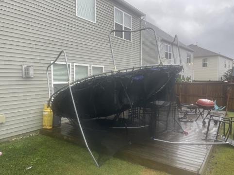
"We've still got more rain on the way, especially from the Triangle north," said WRAL meteorologist Kat Campbell. "We've already seen inches of rain in some areas. When you combine that with strengthening winds and some gusts, with the wet grounds, those wind gusts could knock down trees and cause power outages."
"My concern is this storm is not going to move to the north/northwest," WRAL meteorologist Mike Maze said. "I think it's going to move to the north and the bulk of the stronger winds are going to move through parts of our viewing area as we head through the evening hours."
Around 3:30, flood advisories were issued for 13 counties in the area including Wake, Johnston, Wayne and Harnett counties as heavy rain continues to fall.
Around 2:05, the center of Ian made landfall near Georgetown, South Carolina with maximum sustained winds of 85 MPH. This marks the third time Ian made landfall, this time as a Category 1 Hurricane. Coastal South Carolina was seeing some significant damage, flooding and first responders were making rescues.
Myrtle Beach fire crews helped four people who were trapped on the second floor of a building escape from flooding. Storm surge in Myrtle Beach was at 6.2 feet. In all, four piers in Myrtle Beach are seriously damaged.
Elsewhere in Myrtle Beach, a shrimp boat washed ashore after the crew ran into mechanical problems and the boat couldn't move under its own power. The powerful waves swayed the boat onto the beach.

Around 1 p.m., authorities confirmed a pier at Pawleys Island, South Carolina, had collapsed. The police department said the flooding was catastrophic and that locals should stay away from the area. Part of the Cherry Grove Pier was destroyed.

At Sunset Beach, North Carolina, a bridge was closed as water is beginning to breach the causeway to the island. The bridge to Ocean Isle is also closed.
Raleigh impacts

Hazardous conditions continue to spread into central North Carolina from Ian, which is now a post-tropical cyclone.
A tree came down and power lines were down along London Drive in the Budleigh neighborhood in Raleigh. It appeared the tree was blocking the road.
Along East Whitaker Mill Road near Center Road, a tree blew down, taking with it power lines, causing outages in the area. The tree did not fall on a home or block traffic.
There are also reports of multiple trees fallen in north Raleigh near Durant Road and Litchfield Road.
Parts of trees and limbs were also down in Raleigh along Ashe Avenue near Hillsborough Street.
Along Granville Drive and Perquimans Drive in Raleigh, a downed tree was blocking the road.
Durham impacts
A tree fell on Gresham Avenue east of the Northgate Dog Park and Ellerbe Creek in Durham. The downed tree knocked out power for several people living in the Northgate Park neighborhood.
Durham police blocked off Gresham Avenue as they worked to clear the scene.

There didn’t appear to be any injuries.
Around 40 Duke Energy customers along Ryan Street were also without power on Friday afternoon.
Along the Glenn School Road area of Durham County, there were around 400 customers without power.
Chapel Hill conditions
On Rosemary Street in Chapel Hill, a tree branch has knocked out power to about 250 homes.
Also, along King Street a tree fell onto a home. Crews from the Carrboro Police Department, Carrboro Fire Department and Orange County Emergency Services were on scene to clear the tree.
Cumberland County conditions
Cumberland County had downed trees, flooding behind Locks Creek, a basketball hoop on its side and trash cans knocked over along Bombay Drive near Cedar Creek Road in Fayetteville. The area can be prone to flooding due to its proximity to Locks Creek.
Authorities had road closure signs on the ground in anticipation of closing the roads if the neighborhood near Locks Creek floods.
2 p.m. Ian update
The eye of Hurricane Ian is about to make a third landfall on Friday afternoon in the northern reaches of the South Carolina beaches, just south of the North Carolina border. The National Hurricane Center said Ian was "about" to move onshore.
Brunswick County briefly was under a tornado warning, and tornado watches – meaning conditions are right for a tornado to form – extend as far inland as Johnston County.
The surf washed over dunes from Myrtle Beach north to Wrightsville Beach, and roads were flooded up to about a foot in Ocean Isle Beach.
Water covered the boardwalk in Myrtle Beach and was pushing up against doors and buildings along the strand.
"I encourage people to heed the warnings of local officials and make sure you have a plan if you are in an area with a flood risk," said Gov. Roy Cooper on Friday. "We've faced storms like this before and we know what to do," Cooper said.
12 p.m. Ian update
Power lines were down in north Durham on Ryan Street, and contractors were already working to restore power for 40 homes in the area. A viewer sent WRAL News video of a transformer fire along N.C. Highway 54 in Durham in the Woodcroft area.

Even though Ian will drop heavy rains on the Carolinas for hours to come, rain totals are still under 1 inch in most areas. Elizabeth Gardner said this is good news, because road flooding begins around 4 inches. The highest totals were south of the Triangle, in areas like Fuquay-Varina. The highest winds have been reported in Fayetteville, but Gardner said winds will get stronger this afternoon as Ian's center of circulation gets closer to our area.
The tide is rising quickly at beaches in N.C. and S.C. WRAL's Adam Owens was live in Myrtle Beach, where landfall is expected around 2 p.m., and water was getting close to homes and hotels.
In the Triangle, WRAL News received reports of a tree down at a senior home on Whitaker Mill Road in Raleigh. There were at least three other reports of downed trees.
Power outages were increasing, scattered throughout the state. Local roads remain slippery from the rain, but flooding was not a major issue at noon. Closer to the coast, overwash was already becoming an issue.
11 a.m. Ian update
At 11:30 a.m., tropical storm strength winds have reached our area, with a 41 mph wind gust reported in Fayetteville. There were more than 50 canceled flights and 12 delays at Raleigh-Durham International Airport. Power outages are also growing quickly in N.C., with more than 17,000 reported.
WRAL's Amanda Lamb said there is "basically no beach left" at Wrightsville, where Hurricane Ian was causing crashing waves and storm surge. In many spots, the waves reached the dunes, and similar problems have been reported along the N.C. and S.C. coastlines. At Pawley's Island, water was rushing onto the roadway.
As of the 11 a.m. advisory, Ian was still a Category 1 hurricane with winds at 85 mph. The storm was 120 miles southwest from Cape Fear and is expected to maintain its strength as it makes landfall by 2 p.m. near Myrtle Beach.
Hurricane-force winds extend out 70 miles from Ian's center, and tropical storm winds extend out 275 miles.
Trees fell in Sanford and onto a home in Clayton. Those impacts are expected to get worse as Ian gets closer to the Carolinas.

10 a.m. Ian update
It will rain another 12 hours, WRAL meteorologist Elizabeth Gardner said at 10 a.m., but we're still under a 1 inch of rainfall around most of North Carolina, with heaviest totals south of the Triangle. The worst rain will come later this afternoon, when Ian's center of circulation moves over our area. At 10:15 a.m., Ian was still offshore, but landfall is expected near Myrtle Beach within hours.
WCNC Charlotte received reports and video of flooded roads in S.C. near where Ian will make landfall. At 10:30 a.m., wind gusts there were close to 50 mph. No flooded roads have been reported in N.C., but flash flooding is expected to become an issue later today, especially along the coast.
While roads are not yet a huge issue in N.C., powerlines have come down in Morrsiville as Ian delivers rain and winds to the Triangle. No major power outages have been reported in the Triangle, but more than 8,700 are without power in North Carolina.
9 a.m. Ian update
WRAL meteorologist Elizabeth Gardner said flooding will be worst in the Triangle after noon, with the bulk of the rain between 2 p.m. and the evening commute. If you must leave the house, earlier is better, she said.
There was rain and some ponding on the roadways in counties in and southeast of the Triangle at 9 a.m. Rain was very heavy, limiting visibility on Interstate 40 West in Garner. Drivers will need to use caution even if they venture out in the morning.
At 9:30 a.m., wind gusts were already at 30 mph in the Triangle. It's a good idea to charge devices now in case of power outages later.
Waves were crashing along N.C.'s coastline, but the Town of Wrightsville Beach reported no major issues.
The Town of Sunset Beach mandated evacuations over concerns of high tide and associated flooding. Storm surge as high as 4 feet is possible along the N.C. coast, and a hurricane warning is in effect for all of S.C.'s coast.
WRAL meteorologist Aimee Wilmoth said storm surge is already a problem at southern beaches. Conditions are also worsening in S.C., where Ian will make landfall as a Category 1 storm later this morning.
President Joe Biden will deliver remarks on the federal response to Hurricane Ian at 11:30 a.m.
8 a.m. Hurricane Ian update
Ian's track is shifting more east, which puts the Triangle more at risk for flooding and power outage, although the storm will be weaker than when it makes landfall in S.C.
In the Triangle rain was coming in waves, and over 0.5 inches of rain had fallen in some areas at 8 a.m. Gusty winds up to 55 mph and 3 to 5 inches of rain, higher in spots, will be possible by Saturday morning, when Ian will be moving away.
Landfall is expected soon near Myrtle Beach, and conditions are worsening in South Carolina and at Wrightsville Beach, where rain was pouring and rains were strong. The state Department of Transportation posted a photo of N.C. 12, which was open but blocked in parts with sand and water.
Steven Still, New Hanover County's emergency management director, said he is most worried about erosion at Wrightsville Beach, Kure Beach, Carolina Beach and Figure Eight Island.
5 a.m. Ian update
Hurricane Ian was in the Atlantic moving closer to the Carolinas.
Rain was already pooling on roads in the Triangle at 5 a.m., but strong winds were still hours away. The heaviest rain was in southern areas, including Fayetteville, at 6 a.m., but conditions in the Triangle will worsen throughout the day.

Steven Still, New Hanover County's emergency management director, said they are in emergency mode.
"We are in a limited activation right now. At 7 a.m., we'll be opening our emergency operations center (EOC) and we'll stay open until we're no longer needed. If we have some isolated pockets of damage or we have tornadoes we do have standby teams and EOC surge teams."
The 5 a.m. advisory stated life-threatening storm surge and hurricane conditions are expected along the N.C. coast this afternoon.
Shelters open across NC
There are several shelters open across the state:
4 p.m. Friday until 8 a.m. Saturday for overnight stays for single men, women
5 p.m. Friday until 7:30 a.m. Saturday for overnight stays for families
Friday, 10 a.m. to 4 p.m.
Saturday, 10 a.m. to 6 p.m.
Friday, 9 a.m. to 5 p.m. and Saturday, 9 a.m. to 6 p.m.


Related Topics
• Credits
Copyright 2024 by Capitol Broadcasting Company. All rights reserved. This material may not be published, broadcast, rewritten or redistributed.


