Earl's winds and rains blow into Outer Banks
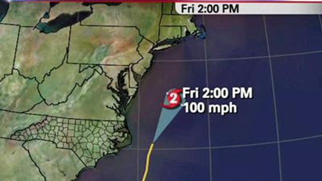
National Weather Service said the eye of the hurricane was expected to get as close as 55 miles east of the Outer Banks about 2 a.m. Friday. The coast is expected to be lashed by hurricane-force winds for a couple of hours with a storm surge of up to 5 feet and waves 18 feet high.
Posted — UpdatedHurricane Earl's winds were slowing, from 140 mph early Thursday to 105 mph, Category 2 strength, by 8 p.m. But forecasters warned that it remained powerful, with hurricane-force winds of 74 mph or more extending 70 miles from its center and tropical storm-force winds of at least 35 mph reaching more than 200 miles out.
National Weather Service said the eye of the hurricane was expected to get as close as 55 miles east of the Outer Banks about 2 a.m. Friday but not make landfall.
"Earl is going back toward the east and this is a clear indication that the storm will not be going over the Outer Banks," WRAL Chief Meteorologist Greg Fishel said.
The coast is expected to be lashed by hurricane-force winds for a couple of hours with a storm surge of up to 5 feet and waves 18 feet high.
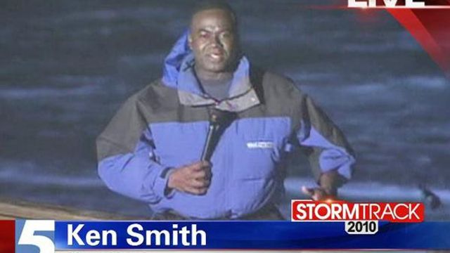
"At Morehead City, winds are gusting to 40 mph, over toward Manteo, winds are gusting to 40 mph and at Diamond Shoals, winds are gusting to 51 mph and waves are up to 20 feet," WRAL meteorologist Mike Maze said early Friday.
Cape Hatteras Fishing Pier, referred to locally as the Frisco Pier, was damaged by high surf Thursday as communities along the Outer Banks battened down the hatches and tourists left the barrier islands.
A hurricane warning remains in effect for all of the Outer Banks and Core Banks and extended from the Bogue Inlet, north of Camp Lejeune, to the southern coast of Massachusetts.
Earl is expected to scuttle out of the area quickly during the daylight hours of Friday morning. Along the Outer Banks, the rest of Labor Day weekend is expected to be sunny and clear, with highs in the mid 80s.
State emergency leaders said they had a "healthy" response to evacuations, mandatory for visitors and voluntary for residents, in northern Dare County, Hatteras and Ocracoke Islands on the Outer Banks, and the Core Banks from Atlantic Beach to Emerald Isle.
"A lot of people were reluctant leavers, but they did," Gov. Beverly Perdue said at a media briefing Thursday.
The last ferry departed at 3 p.m. from Ocracoke Island, which is accessible only by sea and air. It was full for the 2½-trip to Swan Quarter, with about 300 passengers and 50 vehicles.
The ferries will be stowed away and their normal runs suspended until the hurricane passes.
Nancy Scarborough, who manages the Hatteras Cabanas, said that Outer Banks residents have a tight-knit community that takes care of its own.
“I worry about not being able to get back here,’” she said. “I’d rather be stuck on this side than that side.”
Perdue said that anyone who stays to ride it out will be cut off from emergency responders during the storm.
"Once the storm comes in, once it's at its worst point, we are not going to put any emergency worker in harm's way," she said. "There'll be no one to answer the phone or to come up physically to your home."
• Credits
Copyright 2024 by WRAL.com and the Associated Press. All rights reserved. This material may not be published, broadcast, rewritten or redistributed.


