Light snow could dust Triangle
The Triangle could see anywhere from a dusting to an inch of snow as a storm system moves through central North Carolina Friday night into early Saturday, WRAL chief meteorologist Greg Fishel said.
Posted — Updated
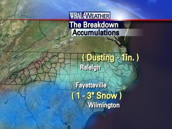
Fishel said the system is mainly going to affect the southeastern portion of the state, but a shift in the storm's path could cause some snow accumulation. The accumulation would occur mostly on grassy surfaces.
WRAL meteorologist Mike Maze said Fayetteville and other areas south of the Triangle could see between 1 and 3 inches of snow.
“It will all be Friday night and exit by Saturday morning,” Fishel said.
By Sunday things will clear up in time for another system to move through on Monday.
“That would be strictly a Monday event,” Fishel said.
It is too soon to tell how much, if any, snow would be created by Monday’s system, Fishel said.
Computer models show the system would move through during the day on Monday.

• Credits
Copyright 2024 by Capitol Broadcasting Company. All rights reserved. This material may not be published, broadcast, rewritten or redistributed.


