Yes! Much-Needed Rain on the Way
The Triangle area is expected to get its most significant rainfall in more than a month on Wednesday and Thursday.
Posted — Updated"No one event is going to end a drought that has built up for months, but the recovery has to start somewhere, and it looks like it will, at least temporarily, over the next couple of days," WRAL Chief Meteorologist Greg Fishel said Tuesday night.
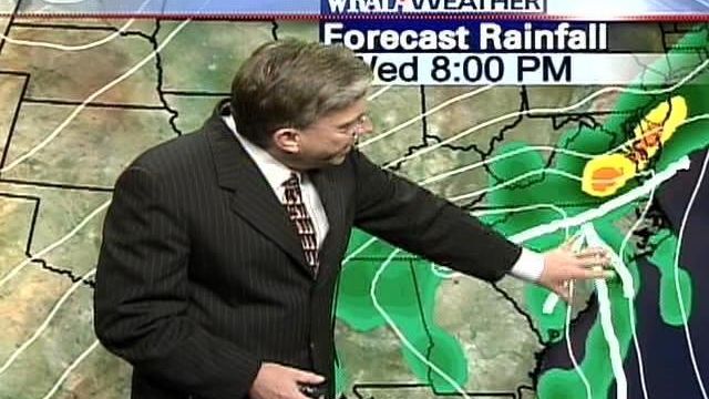
Warm, moist air is going to be pushed in from the Atlantic Ocean, Fishel said, while a cold front comes to meet it from the northwest.
"You feed all this moisture into that area near the front where the air is coming together and going up, and the potential is definitely there for a goodly amount of rain," Fishel said.
After spotty showers during the morning, Wednesday afternoon should bring steadier rain, possibly with thunderstorms. Rain probably will continue Wednesday night and Thursday, Fishel said, and scattered rain could last into Friday and Saturday.
Tuesday night, the first fingers of the weather system began to move across the area, and some thunderstorms developed.
The storms were moving northeast.
Greensboro reported light rain, as did Asheville.
By Saturday, many areas are likely to have seen at least an inch, and some spots may see 2 inches or more, Fishel said.
The last time Raleigh saw a rainfall this substantial was on Sept. 19, when 1.91 inches were recorded at Raleigh-Durham International Airport.
Copyright 2024 by Capitol Broadcasting Company. All rights reserved. This material may not be published, broadcast, rewritten or redistributed.


