Water spouts, record rain soak NC
An unsettled weather pattern that spawned thunderstorms and heavy downpours across central North Carolina throughout the weekend will stay put through the majority of the work week, WRAL meteorologist Aimee Wilmoth said.
Posted — Updated
Monday and Tuesday will be rainy, as a cold front stalled along the North Carolina coast continues to interact with moist air flowing into the state from the Gulf of Mexico.
Thanks to the clouds, temperatures will stay in the low 80s through Wednesday, Wilmoth said. Overnight lows will hover in the mid-60s.
"We have the stalled out cold front that brought us our showers and storms today," Wilmoth said. "The winds will be coming up out of the south and west, and there is moisture to go with it, so we're going to stay unsettled. No widespread severe weather, but it's something we'll keep an eye on."
Storms dropped heavy rain across much of central and eastern North Carolina on Sunday, even setting a record for Aug. 19 at Raleigh-Durham International Airport. The 2.08 inches of rain bested the previous mark, set in 1980, by more than half an inch.
A funnel cloud was reported in Halifax County, but the sheriff's office said it did not appear to have touched down. Radar showed a possible tornado approaching South Weldon and moving northeast through Weldon and Roanoke Rapids at 35 mph shortly after 9 a.m. The tornado warning was canceled around 9:30 a.m.
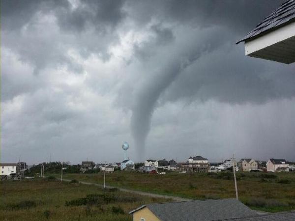
A water spout – which is a tornado over open water – did pass off the coast of Hatteras Island, according to the Dare County Sheriff's Office.
Roanoke Rapids police have gotten numerous reports of golf ball-sized hail and a significant amount of lightning and rain, but no major damage from powerful wind gusts.
Severe weather isn't likely in the first half of the work week, but afternoon storms could include heavy rain, Wilmoth said. Partly cloudy and sunny conditions will return Thursday and temperatures will creep back toward the 90-degree mark by the weekend.
"What a change we're going to see next weekend, with highs in the upper 80s and sunshine," Wilmoth said.


• Credits
Copyright 2024 by Capitol Broadcasting Company. All rights reserved. This material may not be published, broadcast, rewritten or redistributed.


