Heat's impact hits roads, thermostats
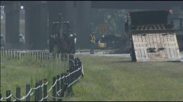
Highway lanes buckled as temperatures soared Friday afternoon in Raleigh, and it was only day one of an extended stretch of triple-digit heat.
Posted — Updated"The record high temperature caused the concrete under the asphalt to swell, and, as the concrete slabs pushed together, the asphalt roadway surface was broken apart," according to a statement from the North Carolina Department of Transportation.
"We've got a pretty old roadway," explained DOT spokesman Steve Halsey.
A hole three feet wide and about a foot deep formed across both lanes, shutting down a quarter-mile section of U.S. Highway 1. Two westbound lanes of I-440 were closed beyond the Jones Franklin Road exit, and all traffic was diverted to the right two collector lanes to travel through to U.S. Highway 1/64 South.
The road reopened just after 8 p.m.
Friday was just the first of a series of triple-digit days, each of which could see the Triangle break an all-time temperature record. The afternoon high of 105 tied that record and blew past the previous record for the date, 101 degrees recorded in 1945.
Even after dark, there was little relief from the stifling heat. At Cary's Koka Booth Amphitheater, the crowd that turned out for an outdoor movie needed fans and plenty of cool drinks.
Across town, Alan Turner was surrounded by explosives at his fireworks tent. Heat from the pavement trapped the rising heat inside. "It would be nice to have a thermometer in here to see just how hot it was," he said.
Power use was greater than normal Friday as homes and businesses tried to keep cool, according to a Progress Energy spokesman, but the utility should have capacity enough to withstand several days of record heat. Demand was expected to decrease over the weekend with most people at home and fewer business open.
Jon Williams, state Secretary of Commerce for Energy, urged residents to turn up the thermostat to ease that load. “If every customer adjusts the thermostat just up to two degrees, it will cut down on the demand for power, help avoid potential blackouts and control utility bills,” he said.
Relief from triple-digit temperatures could come as soon as Monday when the high is forecast to be just 98 degrees. The mercury is expected to stay in the mid 90s through the middle of next week.
A chance for afternoon showers and thunderstorms returns Monday and Tuesday, but the scattered storms will have little impact on the hot weather.
• Credits
Copyright 2024 by Capitol Broadcasting Company. All rights reserved. This material may not be published, broadcast, rewritten or redistributed.


