Log in to WRAL.com with one click using your favorite social network:
OR
Log in using your WRAL.com account:


Wrong email/password combination.

Forgot password?

Register with WRAL.com using your favorite social network:
OR
Register for a WRAL.com account using our web form.

3:08 a.m. • 5-20-13

Weather Forecast for Raleigh

  • Today: Thunderstorm.
    • Hi: 78° F
  • Tue: Thunderstorm.
    • Hi: 84° F
  • Wed: Partly Cloudy.
    • Hi: 86° F

Other Locations

> 7 Day Forecast

Doppler Image

Published: 2012-05-17 14:38:00
Updated: 2012-05-17 18:10:26

Slow-moving storms dump rain on Raleigh, head south


Major Street Flooding In Black Creek, Wilson County
print friendly

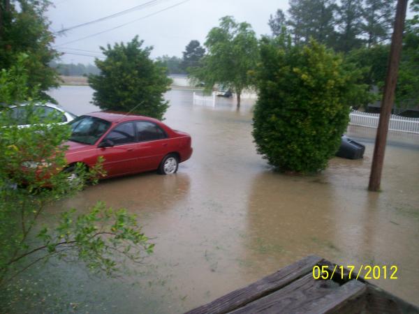
Slow-moving storms dumped rain on Raleigh and several counties south of the Triangle Thursday afternoon.

"We were hoping that there was going to be some shower and thunderstorm activity staying south and east of Raleigh today, but the dry air didn't quite get as far as we thought it would," said WRAL Chief Meteorologist Greg Fishel.

Very strong storms blew across southern Wake County, impacting parts of Holly Springs and Fuquay-Varina, before the weather system moved south into Harnett County shortly after 5 p.m.

Though the storms are strong enough to bring lightning, heavy rain and gusty winds, no severe weather watches or warnings have been issued.

"(There is) nothing severe out of this, but some of these storms could be a little on the gusty side, so be aware of that," said WRAL meteorologist Nate Johnson.

Friday will be nicer with mostly sunny skies, less humidity and a high around 78 degrees.

"(It will be a) very comfortable day tomorrow," Johnson said. "The weekend will get off to a great start, but we start to see the humidity and the chance for thunderstorms return Sunday."

"We're going to kick this stubborn front out of here Thursday evening, but it's going to come rolling back in by Sunday, so we won't get rid of it for long," added WRAL meteorologist Elizabeth Gardner. "That summer-like pattern will be back by early next week and stay with us."

High temperatures will be in the low-to-mid 80s early next week, and a chance for afternoon showers and thunderstorms is in the forecast Monday, Tuesday and Wednesday.


23 Comments


WRAL.com welcomes your comments on this story. All comments are moderated prior to publication based on our posting guidelines. Please review them prior to posting and if your message is not approved.

View Comments VIEW ALL 23 COMMENTS

This story is closed for comments. Comments on WRAL.com news stories are accepted and moderated between the hours of 8 a.m. and 8 p.m. Monday through Friday.

Latest Comments
simplelogic you know you are right about the timing. I was looking at the time stamp also and it's not matching up. And I was looking on the radar last night at home and it showed it was raining in our area but it had already come and gone. Something just isn't right in Gotham (as batman would say!). I'll try Intellicast and see how that works. Thanks for the tip!

Ambygirl, I've noticed for the past few months - maybe 3 or 4 - that many times we get the storms/rain WAY ahead of the radar. By the time the radar image gets to us, the rain has come and gone. The time stamp on the image is up to date, and this happens on computers both at home and at work. I don't know what's going on. I use Intellicast now for my radar updates. It's more sensitive and lots of times shows light rain that isn't hitting the ground, but it seems more accurate and definitely more timely than WRAL's radar has become.

Top this one... Next week WRAL will say were under a drought!!!

Few hours ago WRAL headline said cold front brings clearing and lower humidity. In the story it was said only the SE coastal region could possibly see any storms :)

I do use a different site called noaa.gov which is the best product. I only come here to read the humorous headlines and see what people post.

View Comments VIEW ALL 23 COMMENTS
WRAL Weather on Twitter
  1. nsj: So, I appreciate TWC punting scheduled programming for live coverage, but with regular programming titles like this… http://t.co/oeehYQh3LN
      — Sunday, May 19, 2013 11:10 PM
  2. nsj: Just incredible radar imagery from tornadoes near Wichita and Oklahoma City this evening. Sadly, mapping that to damage becoming too common.
      — Sunday, May 19, 2013 10:30 PM
  3. nsj: (Corrected) More ridiculously low correlation coefficient returns northwest of Pink, OK - under 0.30! Yikes, again. http://t.co/eR7FyIAlU2
      — Sunday, May 19, 2013 10:29 PM
  4. WRALAimee: One of the many tornadoes today...Rozel, KS. No words for this one... http://t.co/Waj30DfnWt
      — Sunday, May 19, 2013 10:27 PM
  5. nsj: RT @4cast4you: News9 in OKC interviewing survivor who said she watched TV coverage on the kids' phones while in the basement.
      — Sunday, May 19, 2013 10:20 PM
  6. WRALAimee: Finding it hard to concentrate on work with all the OK/KS tornado stuff... Sure hope everybody there is ok!!!
      — Sunday, May 19, 2013 8:14 PM
  7. nsj: More ridiculously low correlation coefficient returns due west of Pink, OK - under 0.30! Yikes, again. http://t.co/eR7FyIAlU2
      — Sunday, May 19, 2013 7:23 PM
  8. nsj: Speaking of 1-minute TDWR data… here’s TOKC. http://t.co/3US4CYIv0x
      — Sunday, May 19, 2013 7:09 PM

Follow: WeatherCenter | Maze | Fishel | Gardner | Johnson | Wilmoth