Coming cold front could pack a stormy punch
"There's pretty spring weather in our forecast. It will just be a stormy day Wednesday," WRAL meteorologist Elizabeth Gardner said.
Posted — Updated
"Our chance for rain today is slim," WRAL meteorologist Elizabeth Gardner said Tuesday. "It goes way up tomorrow as a cold front goes through, and we have a chance for severe weather."
Clouds will thicken throughout Tuesday, and temperatures will hit a high around 79 degrees.
"There is a slim chance of a shower or thunderstorm later this afternoon, mainly from the Triangle west, but most folks are going to be dry today," Gardner said.
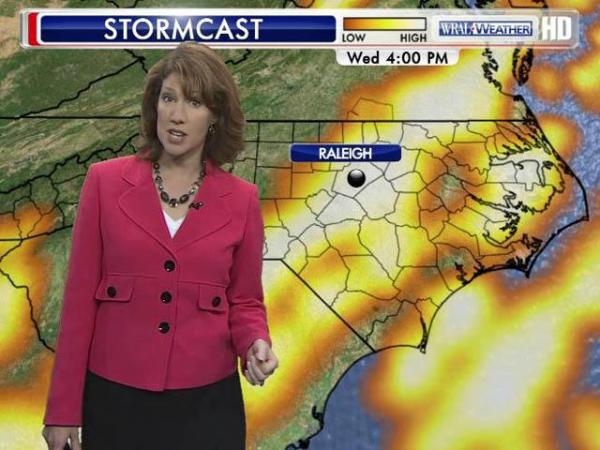
Showers and storms will start up Wednesday morning and could become severe in the afternoon and into the night. The biggest threats are heavy rain, isolated flooding, hail and damaging winds.
Rainfall could total up to an inch in spots but will vary according to which spots get the bigger storms.
"You know thunderstorms. They're never equitable in how they dump rain across the area," said Gardner.
The chance for storms will last until around midnight Wednesday.
"After that, we have gorgeous weather Thursday through Monday," Gardner said.
Those days, high temperatures will range from the mid to upper 70s, the sun will shine, and the chance for rain will stay away.


• Credits
Copyright 2024 by Capitol Broadcasting Company. All rights reserved. This material may not be published, broadcast, rewritten or redistributed.


