Weather
trails on satellite
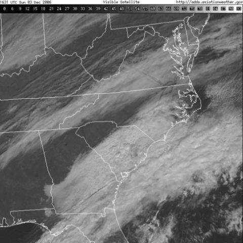
This satellite image from 2006 includes several dissipation trails produced by aircraft, mainly seen over northeastern NC and southeast VA, in addition to a longer one running northwest across central VA.
This satellite image from 2006 includes several dissipation trails produced by aircraft, mainly seen over northeastern NC and southeast VA, in addition to a longer one running northwest across central VA.