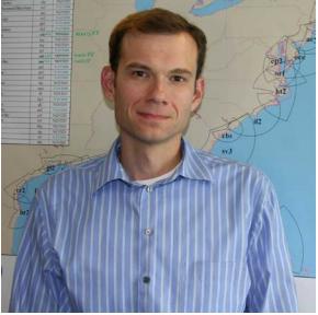
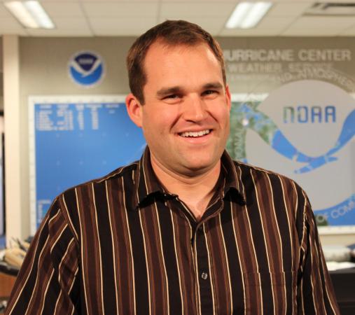
Robbie Berg is a hurricane specialist with the National Hurricane Center in Miami. He earned double bachelor’s degrees in meteorology and marine science from North Carolina State University in 2001, graduating as valedictorian with a perfect grade point average. Berg is responsible for forecasting and tracking tropical cyclones, issuing cyclone watches and warnings and conducting education and training for emergency managers, forecasters and the public. He lives in Doral, Fla., with his cats, Nimbus and Sandstorm.
WRAL: Why did you choose the field of meteorology?
Berg: Almost every meteorologist answers this question with the same type of response. I think it’s an undiscovered gene or something. I have so many memories of what I was doing during specific weather events. Growing up in New York, I remember building caves in the deep snow after an ice storm and watching out the window as leaves and tree branches blew by during Hurricane Gloria. After my family moved to the Asheville area, I remember riding the school bus in the winds and rain from Hurricane Hugo and being startled by a clap of thunder while sledding in the snow during the 1993 Superstorm. I still remember the first time I got a cheap pair of polarized sunglasses as a kid and was able to clearly see clouds at different levels in the sky moving in different directions. Before that, I didn’t know the sky was so complex. By high school, I was becoming especially intrigued by hurricanes. I always had my hurricane tracking chart nearby, and during the summer I would try to catch the tropical update on The Weather Channel. Even after making up my mind to attend N.C. State for meteorology, I went through several other major weather events, including hurricanes Floyd and Bonnie and the surprise 21 inches of snow in Raleigh in 2000. One of the most vivid memories had to be getting soaked at an N.C. State football game against South Carolina during Tropical Storm Dennis. Only a meteorologist would remember which storm that was.
WRAL: You spent eight months as a WRAL intern in 2001. What was that like?
Berg: I was an intern at WRAL during my senior year at N.C. State and worked for Chief Meteorologist Greg Fishel. I would come in during the evening newscasts, so much of the time I also worked with Elizabeth Gardner and Leon Smitherman (who was the chief meteorologist for FOX50 at the time). When I first started at the station in the fall, the current newsroom was still under construction, and the Weather Center was stuffed back in what looked like a closet. Being in such a confined space with Greg and Leon was something else. When you put the two of them together, you never knew what to expect, or what kinds of conversations you would have that day. The experience was great, and I always looked forward to going to work because I knew I would probably be laughing the entire time.
Aside from helping put together on-air weather graphics and doing a little bit of forecast verification, Greg let me come up with weather questions for the Weather School segment he would do before the weathercast. I loved that I was allowed to be creative, and it was fun to play around a little with the questions. Greg was always such a good sport, and I was so privileged to be able to work with him.
WRAL: There’s been so much emphasis placed on educating the public about the dangers of hurricanes and the importance of preparedness, especially in the last decade. Do you think the message has gotten through?
Berg: It’s hard to answer that question with a simple yes or no. By definition, communication is about informing and persuading. I think most of the time the message itself gets through, so we’re doing a decent job with the informing part. With the Internet, we’re able to provide our forecasts to more people than ever before, more quickly than ever before. Now we’re using Facebook and Twitter as a more personal way to connect with people. And, it doesn’t take much to get people interested in hurricanes. I remember when we stopped at Raleigh-Durham International Airport on our Hurricane Awareness Tour with the NOAA P-3 aircraft back in 2009. Of all the outreach events I’ve been a part of, I have never seen so many people show up to be a part of the experience.
It’s the persuading part of the definition that is more difficult. How do you persuade an elderly man to leave his home and belongings even though storm surge may wipe it all away? How do you persuade a single parent to purchase storm shutters or board up their house if they can barely make ends meet financially? How do you persuade someone who lives in a mobile home to go to a shelter where, unfortunately, it won’t be a comfortable experience? How do you persuade a multimillion-dollar corporation to not build an expensive hotel right on the beach? Those are some of the questions that we struggle to answer.
WRAL: One of your roles at the Hurricane Center is to work with the scientific community to improve the communication of forecast information. How do you do that?
Berg: I’ve really gotten involved with the social science community and watching how we communicate our forecasts. When you interact with the public and emergency managers as much as we do, you begin to realize how often things we say or graphics we show get misinterpreted. In the end, forecasts are practically worthless if the people who need them don’t understand them.
In 2010, I attended the Weather and Society Integrated Studies workshop in Boulder, Colo. (WRAL’s Nate Johnson and the hurricane center’s Jamie Rhome are other alumni). Meeting other people in the workshop made me realize that the weather community as a whole doesn’t do a very good job working with the expertise of social scientists to shape our messages with the values and behaviors of people in mind. Even if we do take those into consideration, we don’t always recognize that most of us have not been trained in the social sciences and we need help. At the National Hurricane Center, we’re now involved in a comprehensive effort to create new forecast graphics that are more understandable to people, and we’re working with some great social scientists who are doing surveys and testing the graphics with people who would eventually use them. We’re also testing forecast products that will hopefully fill voids where our communication on certain hurricane hazards has been lacking. The most important part of this process is that social science is included from the beginning—we’re not creating graphics on our own and then showing them to a social scientist and saying “What do you think?” That would be like me self-diagnosing an illness, writing out my own prescription, and then asking the doctor to sign it. It’s not supposed to work that way.
WRAL: Scientifically speaking, what’s the toughest aspect of hurricane forecasting?
Berg: Intensity, especially rapid intensification. Changes in the strength of a hurricane are part of a very complex interaction of processes, and we don’t really have enough computing power to accurately model what’s going on in the storm. We also have very general rules and thresholds we use when trying to forecast intensity, but sometimes it just doesn’t work out that way. For example, when a storm moves over ocean water that is colder than about 80 degrees, it should begin to weaken. However, we’ve seen hurricanes over the north Atlantic where the water is more like 65 degrees. Sometimes all the conditions appear right for an area of showers and thunderstorms to become a hurricane, but nothing happens. I can’t tell you how many times I’ve put out a forecast for a storm and within hours it’s obsolete because the storm strengthened more than I thought it would.
Our errors in forecasting where a hurricane will go have been cut in half over the past two decades, and our skill in track forecasting has gotten good enough that we started five-day forecasts in 2001. We’re even now thinking about doing seven-day forecasts. Our intensity forecast errors, on the other hand, have not budged. A lot of money is being pumped into the intensity forecasting problem, and hopefully the models will get good enough that we’ll start to see a decrease in the errors within the next decade.


