
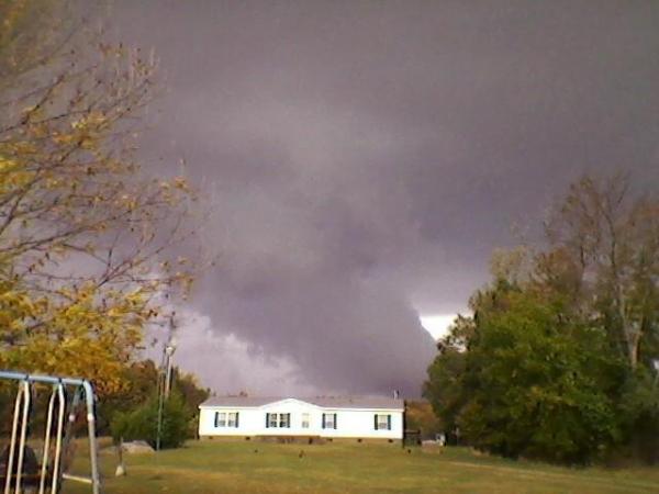
Wednesday evening, October 27th proved to be an active one from northern and northwestern parts of our viewing area, with a pair of intense supercell thunderstorms sweeping through the area and prompting a series of tornado warnings, all within a larger weather pattern that had led to a tornado watch for much of western and central North Carolina at that time.
The warnings that were issued for parts of Person, Orange, Granville and Vance counties verified in the form of five separate tornadoes, and the National Weather Service office in Raleigh has since posted detailed descriptions of each tornado along with maps of the path followed by each twister, and some associated damage photos. I've included a link here to a pdf document containing all of that information. Also, if you'd prefer to view the tracks on a Google Earth background, they've provided a kml file with that data, and I've included that link here as well.
An approaching pair of upper level disturbances should bring lots of clouds and some precipitation to our area at times Wednesday into Thursday, but so far it appears it will generally involve very stable air over our part of the state, with little in the way of severe weather potential.
Copyright 2024 by Capitol Broadcasting Company. All rights reserved. This material may not be published, broadcast, rewritten or redistributed.


