Aug 6th a around 6:45pm we had an unusal storm. severe wind, donpour in 5 min 1 inch. trees topple along a staight line and hail. Power outage because of downed trees and Power outage lasted from 7:00pm until 1:00am. this happened at jessie bridges road in chatham county. thisis in the north western corner of chatham. Question is did you see anything on radar to support this. I am 61 and have never heard or seen such a quick storm come up , do so much damage and last such a short time. thanks
Posted — Updated
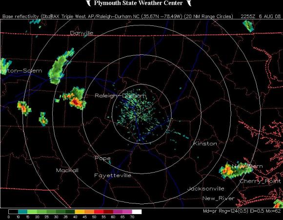
MIKE MOSS SAYS: Gwen, The attached image from the radar archive site at Plymouth State University shows the storm cell you are referring to about the time it reached its greatest intensity. The cell moved from just south of Greensboro in Guilford County southeast across your area and finally weakened greatly as it moved into Lee county a little later on.
While it is not unusual to have a very intense storm like that around our area once in a while, for any specific location a storm strong enough to produce the kind of rainfall intensity you mentioned is a rare occurrence, since you measured what would amount to a 12"/hour rainfall rate! Also, the majority of severe storms in our area tend to move along a southwest to northeast track, while this one moved in a less common direction, northwest to southeast.
Copyright 2024 by Capitol Broadcasting Company. All rights reserved. This material may not be published, broadcast, rewritten or redistributed.


