One Last Word on Last Weekend's Snow
First, let me preface this by saying that falling snow is pretty, but it's not until that snow starts to accumulate does it become fun. If you can't make a snowman out of it or sled down a hill with it, it's not much more than a pretty picture.
Posted — Updated
First, let me preface this by saying that falling snow is pretty, but it's not until that snow starts to accumulate does it become fun. If you can't make a snowman out of it or sled down a hill with it, it's not much more than a pretty picture.
So, since most folks didn't see any of last Saturday's snow stick, it really wasn't much fun. Sure, it was nice to look at, but it didn't add up to anything.
Or did it?

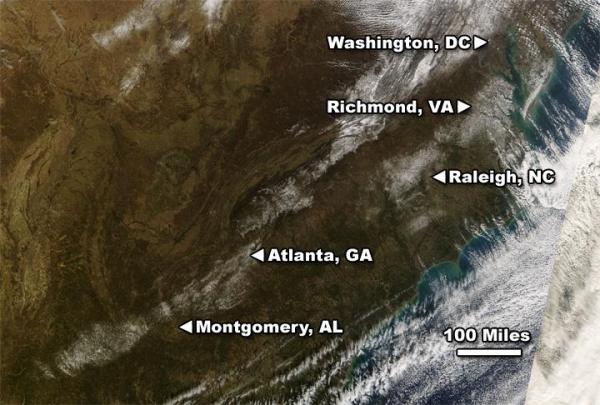
It shows an area stretching from south of Burlington across northern Chapel Hill and up toward Roxboro where two or more inches of snow fell last Saturday. It also shows the relatively heavier snowfall south and southwest of Fayetteville, as well.
Even though we didn't see much accumulation, it was still enough to see from space. NASA's Terra satellite carries a special high-resolution imager called MODIS. On Sunday, January 20th, MODIS captured this image, showing the snow across the western Triangle, as well as the heavier snow in the Sandhills:
Hopefully, we'll see more snow before the winter is over -- snow we can not only look at but play in, as well.
Copyright 2024 by Capitol Broadcasting Company. All rights reserved. This material may not be published, broadcast, rewritten or redistributed.


