
High temperatures that reach or exceed 100 degrees are thankfully not a common feature of our weather pattern across central North carolina, but every so often, usually during a somewhat dry stretch, we do hit the century mark. Because it takes a fairly unusual combination of weather features to drive our temperatures to that level, it can be difficult to forecast confidently, as a well-timed isolated shower or patch of thicker than expected clouds, or winds that end up 20 or 30 degrees off from the expected direction, can shave a few degrees off the observed temperatures.
With all that in mind, though, we do seem to be heading into a stretch this week that could produce a couple of days with RDU at or just above triple digits, with the best chances looking like Tuesday, Wednesday and Thursday. Through that period, computer models sugest a strong upper level ridge will continue to build just to our west and southwest, leaving us with low to mid level winds that include a westerly component that often produces dry conditions and some added compression due to downslope flow off the mountains. We already made it to 98 on Sunday afternoon (with 102 at Fayetteville). Luckily, dewpoints fell into the upper 50s to low 60s in the afternoon so that the heat didn't feel as oppressive as it could. Those models are suggesting a gradual increase in our humidity levels, though, so even in the afternoon by midweek dewpoints may hold in the mid 60s to around 70, adding to our Heat Index, which could reach the 105-110 range on occasion this week.
It will be a close call as far as record highs go. Already, August 7th, 8th and 9th have records of 100, 101 and 100 respectively, and we're expecting to be right in that ballpark. We currently have 2 consecutive days at 101 in our forecast, and if that turns out to be the case it will be the first consecutive days reaching or passing 100 at RDU since July 26th and 27th of 2005, and before that, August 23rd and 24th of 2002. Our longest stretch of triple digit readings was four in a row, which occurred August 20-23 1983. Here's hoping we don't tie THAT record this week! Also, in case you're wondering, the record high temperature all time for RDU is 105 degrees, which last occurred Aug 18th, 1988.
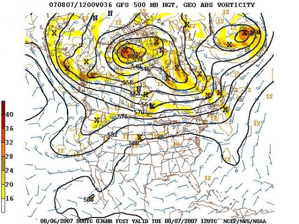
There does appear to be some hope for relief toward the weekend, with longer range models indicating a breakdown of the upper level ridge (see attached images, from the National Centers for Environmental Prediction) that would allow a trough to develop aloft over the eastern U.S., driving a cold (or "cooler") front to our southeast sometime Saturday. It's a little early to have much confidence about that, but if we're lucky we may have highs back down in the in the 80s by Sunday. It would be nice if we also had less haze and clear skies, since Sunday night should be the peak of this year's Perseid meteor shower. For more info on that, see the "Carolina Skies" section of our web site and the recent blog entry there previewing the shower.
In the meantime, keep all the usual common sense tips for coping with heat and humidity in mind, and for those who might have respiratory issues, there will likely be some Code Orange and possibly Code Red ozone days to deal with - see the "Air Quality Forecast" link on our main weather page for more on that.
Copyright 2024 by Capitol Broadcasting Company. All rights reserved. This material may not be published, broadcast, rewritten or redistributed.


