Warmest temperatures of 2013 arrive in Triangle
The warmest temperatures of the year will arrive Tuesday afternoon across central and eastern North Carolina, setting up a three-day stretch that will include highs well above normal for early April.
Posted — Updated
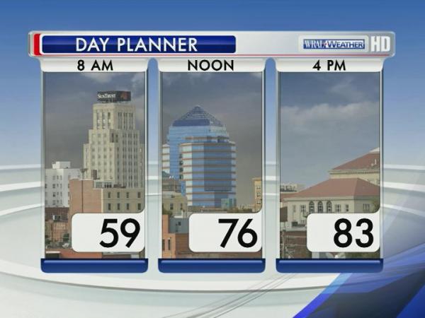
With sunshine the dominant weather feature Tuesday afternoon, much of the Triangle will see the first 80-degree day of 2013, WRAL meteorologist Elizabeth Gardner said.
"We haven't been in the 80s since Oct. 25, 2012, but we'll get there this afternoon," Gardner said. "In fact, we'll be 5 to 10 degrees above normal by late this afternoon."
Temperatures were near 80 degrees at noon and will climb into the low 80s during the afternoon.
Wednesday's weather will be similar, as warm overnight temperatures will allow highs to climb into the mid-80s during the afternoon under mostly sunny skies.
"We'll be about 5 degrees away from a record high Wednesday, which is pretty remarkable when you consider our cold weather recently," Gardner said. "Definitely an abrupt change."
Along with the warm temperatures, humid air is also making a return to the area thanks to a high pressure system hovering off the East Coast.
Clouds will thicken through the day Thursday as a cold front approaches from the west, and by Friday morning the central part of the state could see strong to severe thunderstorms.
"This weather system is going to arrive late Thursday and be sitting right on top of us Friday morning," Gardner said. "We'll have a wet commute for sure, and we could have the threat for some severe storms."
Sunshine will return once the front clears, setting up a picture-perfect weekend that will include mostly sunny skies and high temperatures in the mid-70s.


• Credits
Copyright 2024 by Capitol Broadcasting Company. All rights reserved. This material may not be published, broadcast, rewritten or redistributed.


 for 2024 season")


