Triangle under flood watch through Friday
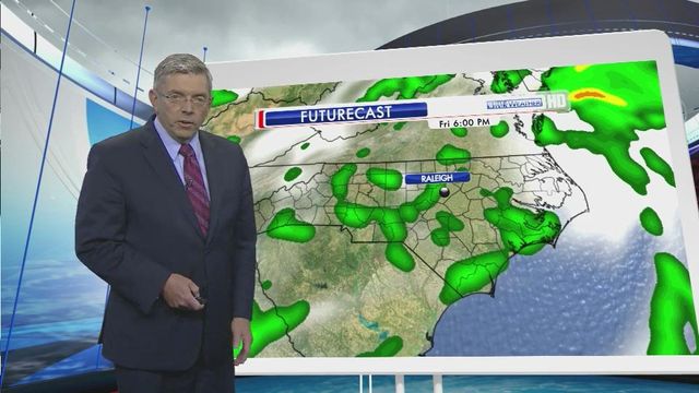
Tropical Storm Andrea continued its track across the Southeast on Thursday night, promising to push plenty of rain to the Triangle by morning, WRAL Chief Meteorologist Greg Fishel said.
Posted — UpdatedAndrea made landfall at 5:45 p.m. in Florida's Big Bend area with maximum sustained winds of near 65 mph.
At 11 p.m., the storm was moving northeast at 15 mph with sustained winds of 45 mph. Although the center was still 400 miles southwest of Raleigh, rain was reaching as far north as Fayetteville.
The storm will continue to weaken over land, but forecasters warned it could cause isolated flooding and storm surge before it loses steam over the next two days.
Three to 6 inches of rainfall is projected for most of North Carolina, depending on the storm's track. The state's average June rainfall is 3 to 3.5 inches.
"For now, the tornado threat is minimal, also the wind threat is minimal. The hail threat is nonexistent," Fishel said. "The biggest threat is going to be from flooding. That's why a watch has been issued by the National Weather Service for this entire area."
Flash flood watches have been issued for counties including Wake, Durham, Johnston, Orange and Cumberland through 6 p.m. Friday.
The rain will intensify early Friday, with very heavy rain falling during the morning's commute.
"We could actually see the heaviest rain in the first part of the day," Fishel said. "And then things become more scattered in nature" as the storm weakens.
Forecasters predict the storm will continue along the East Coast through the weekend before heading out to sea again, though a storm's track is often hard to predict days in advance.
John Elardo, a meteorologist with the National Weather Service in Newport, N.C., said the storm would push major waves to the north and northeast, away from the Outer Banks, where a series of storms in the fall and winter wore away dunes and washed out portions of N.C. Highway 12, the only road connecting the barrier island to the mainland of North Carolina.
Andrea could bring up to a foot of flooding on the sound side of the Outer Banks, Elardo said.The rain threatened to ruin a beach day Friday for Angela Hursh, 41, of Cincinnati, who had rented a house in Frisco, N.C. Hursh was planning to soak in the hot tub and watch movies with her 9-year-old and 13-year-old daughters.
"I think we're just going to hunker down and eat junk food," Hursh said.
Doug Brindley, who owns a vacation lodging rental service on the northern end of the Outer Banks near Virginia, said he expects all outdoor activities to be washed out Friday, driving tens of thousands of early-summer vacationers toward unexpected shopping sprees.
"We're going to have rain and wind," said Brindley, who owns Brindley Beach Vacations and Sales. "Retailers are going to love it."
He expects new visitors streaming south from their homes across the U.S. Northeast to arrive tired and grumpy.
"They're going to be driving through that mess," Brindley said.
• Credits
Copyright 2024 by WRAL.com and the Associated Press. All rights reserved. This material may not be published, broadcast, rewritten or redistributed.


