Fishel: Too soon to tell Tropical Storm Chantal's impact on NC
WRAL Chief Meteorologist Greg Fishel said it's too soon to tell whether Tropical Storm Chantal, the third named storm of the Atlantic hurricane season, will affect North Carolina.
Posted — Updated
"There are no concrete indications that it will affect us," said Chief Meteorologist Greg Fishel. "It's still a long ways away."
The storm formed southwest of the island chain Sunday night to become the third named storm of the Atlantic hurricane season.
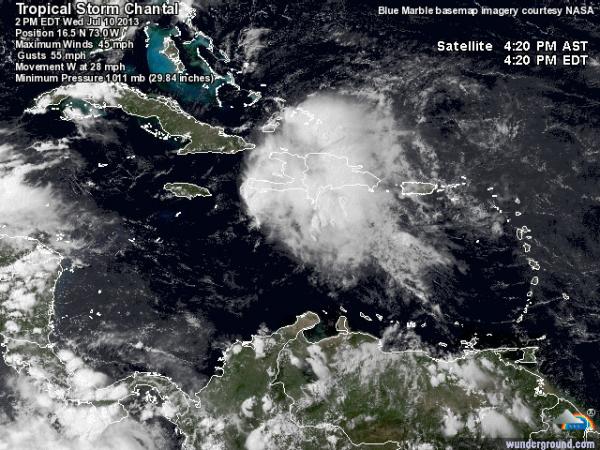
At 5 p.m. Monday, Chantal had maximum sustained winds of 45 mph and was moving west-northwest at 26 mph. The storm is about 2,400 miles southeast of Raleigh.
A tropical storm warning was in effect for Barbados, Dominica, Saint Lucia, Martinique and Guadeloupe, and a tropical storm watch was in effect for Saint Vincent.
The center of Chantal was forecast to approach late Monday night or early Tuesday and move into the East Caribbean Sea on Tuesday.
"It becomes a low pressure system, just a tropical depression off the coast of Florida, by the weekend, but it's awfully close to the coast," WRAL meteorologist Elizabeth Gardner said. "As much rain as we've had lately, even if this is just a tropical depression and comes up into North Carolina, it could cause some issues for us in terms of flooding."
Gardner said any effects from Chantal wouldn't affect North Carolina until early next week.
Erick's maximum sustained winds have decreased to near 50 mph (85 kph) with gradual weakening expected to continue over the next two days.

• Credits
Copyright 2024 by Capitol Broadcasting Company. All rights reserved. This material may not be published, broadcast, rewritten or redistributed.


