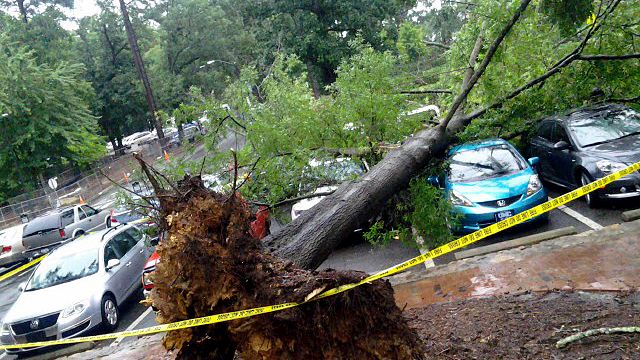
Widespread heavy rains continue dousing central NC
A large swath of showers stretched from southern Virginia through central North Carolina into South Carolina for much of Tuesday afternoon, dumping heavy rain in many spots across the Triangle as it trudged slowly east. "It is unusual to have a day like today, when it is just raining all day long, in July," said WRAL Chief Meteorologist Greg Fishel.
Posted — UpdatedThe National Weather Service issued a tornado warning for Person County about 12:15 p.m. after radar indicated rotation within a storm, but the alert was canceled 15 minutes later after the storm moved into southern Virginia.
No damage has been reported due to the storm.
A large swath of showers stretched from southern Virginia through central North Carolina into South Carolina for much of the afternoon, dumping heavy rain in many spots across the Triangle as it trudged slowly east.
"It is unusual to have a day like today, when it is just raining all day long, in July," said WRAL Chief Meteorologist Greg Fishel.
"We have a low pressure system to our west and a Bermuda high off the coast, and those two systems will continue to help push showers into the Triangle for the next couple of days," she said. "Tuesday's showers will be scattered, but the chance for rain will be with us all day long and we could see more impressive totals by Wednesday morning."
The National Weather Service extended a flash flood watch again Tuesday evening for dozens of counties in the middle of the state. Orange, Durham, Wake, Johnson, Wilson, Nash, Edgecombe, Halifax, Sampson and Wayne counties will remain under a watch through Wednesday evening.
Some spots could see an additional 1-3 inches of rain before the area begins to dry out late Thursday and into the weekend. High temperatures Tuesday topped out in the low 80s thanks to cloudy skies.
"We do have the potential to see big rain totals in those areas where we see heavier showers," Gardner said.
Teams of firefighters, police officers and public works employees will return to impacted areas Tuesday to continue getting an accurate count of how many homes and vehicles were battered by floodwater.
A total of 4.66 inches of rain fell in Chapel Hill on Sunday, according to data from the State Climate Office.
"More rain is definitely coming," Gardner said. "We're in this pattern where it's like someone opened up the fire hose and aimed it at North Carolina."
The National Weather Service advises motorists to refrain from driving into areas where water covers roads. As little as 6 inches of water can cause a driver to lose control. Two feet of rushing water can carry away most vehicles, including SUVs and pickups.
The chance of heavy rain will decrease late in the week, and sunshine will return in earnest by the weekend. Temperatures will also return to July normals, climbing into the low 90s by Friday, Saturday and Sunday.
• Credits
Copyright 2024 by Capitol Broadcasting Company. All rights reserved. This material may not be published, broadcast, rewritten or redistributed.


