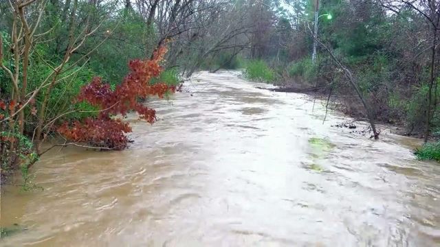
Severe weather moves out, leaves floods behind
A steady stream of showers and storms continued to push through central and eastern North Carolina Wednesday afternoon, creating minor flooding issues in parts of the Triangle as procrastinators take care of last-minute Christmas chores.
Posted — UpdatedRain began falling in the early-morning hours, and it was heavy at times through the morning and early afternoon. Flash flood warnings issued for Durham, Wake, and Orange counties expired at 8 p.m. and severe thunderstorm warnings were in place for several cities during the afternoon hours.
The heavy rain forced people in one Chapel Hill neighborhood to evacuate their homes at the Brookwood Condo Complex on South Estes Drive as water began rushing in from the rising Bolin Creek. Flooding has been a problem in the area before and dozens of units in the complex were damaged by flooding in July 2013.
Water around the condos quickly receded but several people had to be transported in and out by the Chapel Hill Fire Department while water covered the road.
Chapel Hill Fire Chief Matt Sullivan knows that the rising of Bolin Creek can be problematic during heavy rain.
"It crests the banks of the creek and starts to flood parking lots and access points," he said.
In neighboring Camelot Village, Shon Cameron watched the water-line creep toward his front door. He lives in another spot that has flooded in the past.
"You know the drill already, you move your car to higher ground," he said. "Be ready in case it does come in, you have all your things up and have to leave."
High water was especially problematic in parts of Durham. Authorities were forced to close portions of several roads, and police said they received about 20 reports of high water during the morning and early afternoon hours. The Eno River overflowed its banks in some areas and officials closed West Point at the Eno early in the day. The town of Hillsborough closed the Riverwalk Greenway and Gold Park on Tuesday and they remained closed Wednesday evening due to flooding.
Weaver Street Rec Center was also shut down while all programs at Forest Hills Park were canceled until the water recedes.
Durham police also had multiple reports of flooded and stranded cars in the area.
No injuries were reported.
In Wake County, high water forced authorities to shut down Piney Plain Road in both directions between Wade Nash and Spence Farm roads.
WRAL meteorologist Mike Maze said that although the threat for sever weather was gone Wednesday night, the possibility still exists for an isolated thunderstorm on Christmas Eve before drier air pushes in during the afternoon.
Tornado warnings were issued Wednesday morning for several counties in southeastern North Carolina, but no funnel clouds or damage were reported as a powerful storm cell moved through Bladen, Sampson and Duplin counties.
The first warnings were issued before 8 a.m. as a strong cell pushed through Bladen County. Sampson and Duplin counties were put under warnings at about 8 a.m., and the National Weather Service canceled the Sampson County alert at about 8:30 a.m.
“We haven’t had any reports of damage or funnels on the ground, but we did see rotation with this storm as it moved northeast through those rural counties,” Wilmoth said.
• Credits
Copyright 2024 by Capitol Broadcasting Company. All rights reserved. This material may not be published, broadcast, rewritten or redistributed.


