Sunshine, cooler temps arrive behind cold front
Sunshine returned to parts of central and eastern North Carolina Saturday afternoon after a powerful cold front that brought storms to the area Friday night pushed off the East Coast.
Posted — Updated
Skies cleared gradually from west to east during the morning hours, and parts of the Triangle began seeing breaks in the cloud by 1 p.m.
"We are seeing some clearing from west to east, but it's going to be a slow process, especially for the eastern portion of the state," WRAL meteorologist Mike Moss said. "Expect to see some sunshine peeking through by lunchtime in the Triangle, and it will continue to clear out this afternoon."
The line of severe thunderstorms that marched through the area Friday afternoon downed tree branches and power lines, knocking out service in several areas.
The weather service posted a tornado watch, indicating conditions were favorable for tornadoes, at about 2 p.m. Friday. As the storms weakened and night fell, those watches were gradually lifted. After the line passed, more moderate weather moved into the area.
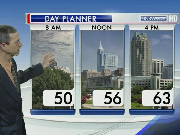
"A high pressure system will control our weather the next couple of days, but we will be much cooler than we've gotten used to," Moss said.
Highs Sunday will top out in the mi-60s again, but Monday's top temperatures could stay in the upper 50s.

• Credits
Copyright 2024 by Capitol Broadcasting Company. All rights reserved. This material may not be published, broadcast, rewritten or redistributed.


