Regardless of Joaquin's track, heavy rain is coming to central NC
In the coming days, it will be very easy to focus our attention on what may or may not happen with Hurricane Joaquin. None of this is to suggest that it will not be a big event nor that we should ignore it in any way.
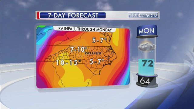
However, before Joaquin does whatever it will do, we will have a widespread, significant rainfall – likely 3 to 4 inches everywhere in our area with pockets much higher than that. That rain sets up shop Thursday and sticks around through Saturday, at least.
On top of the rain we’ve already seen, this new rain could cause problems including flooding. That all happens whether Joaquin eventually makes a direct hit to NC or veers completely out to sea.
Of course, every drop we get only further sets the table for potential problems if Joaquin decides to make a close pass (or worse) at North Carolina, which would likely not be until Sunday or Monday.
Saturated soil around central North Carolina takes on the consistency of pancake batter, so it wouldn’t take much wind to topple trees, power lines, etc., which we could get even if Joaquin goes well away from us.
Were the storm to take closer aim at NC, obviously, we’d expect widespread downed trees and power outages in addition to flooding, but it’s too soon to focus on that possibility – only one possibility of many with this storm.
What is more likely, and what will happen between now and then, is a widespread rain event with attendant street, urban and river flooding. It's something we cannot ignore.


