Slow melt begins as temperatures climb; some slick spots remain
The snow, sleet and freezing rain that caused chaos on area roadways Friday began slowly melting late Saturday morning, but slick spots will likely remain in spots thanks to temperatures hovering just about freezing.
Posted — Updated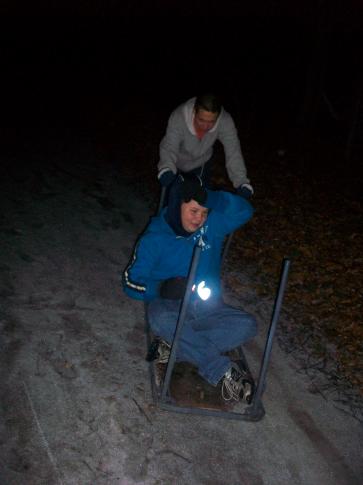
“This melting is going to be a slow process, so just be patient,” WRAL meteorologist Elizabeth Gardner said. “We might not see things really start to warm up until closer to noon, and we’ve got some cloud cover keeping the sun from doing a whole lot of work.”
A winter weather advisory issued for much of central North Carolina Friday expired at 11 a.m., but cold temperatures were going nowhere fast under mostly cloudy skies.
Road crews hit area roadways at 5:30 a.m., treating them with a sand and salt mixture and salt alone. Despite that, officials urged residents to stay off the roads if possible Saturday morning.

“If you don’t have to get out, just wait a little bit,” State Highway Patrol 1st Sgt. Jeff Gordon said. “Speed has been the number one factor when we’ve responded to collisions. Reduce your speed, increase your following distance and be careful if you are out on the roads.”
At one point there were five active accidents on Interstate 95 Friday evening. The highway was closed in both directions from about 4 p.m. until after 6 while crews tended to the injured and cleared the vehicles involved. Many cars spun, slid and flipped, but no serious injuries resulted.
Gordon said all the major highways in the Triangle saw some trouble spots, and that more than 200 accidents were reported Friday in Wake County. The highest volume was between 2 and 4 p.m. as people tried to get home and a second wave of freezing rain fell.
A school bus carrying 21 elementary students slid off snow-slicked Fox Road in Wake County and into a tree Friday afternoon. Two of the students on the bus, which departed from North Ridge Elementary School, were taken to an area hospital with minor injuries, according to a spokesman for Wake County schools.
One fatal crash is attributed to Friday's slick roads. Wendell police said Stanley Thompson, 62, died in a collision at the intersection of Whitely Way and Wendell Boulevard. Four others were involved in the crash, and they were being treated Friday night at WakeMed.
For those who have no choice but to drive before the snow and ice melts Saturday morning, authorities offered the following guidelines.
- Clogged roadways can make it difficult for snow-removal crews and emergency personnel to do their jobs.
- Make sure your cell phone is fully charged.
- If you don't have a garage or carport, parking near a wall or building can protect your car from the cold to some degree.
- Check the power levels and water in your car battery. If your car is not housed in a garage, it is crucial to have a heating system for your engine if there are extremely low temperatures for long periods.
- Keep your gas tank filled. Doing so will keep condensation from getting in the tank. Condensation can contribute to fuel line freeze-up.
- Make sure your exhaust pipe is not clogged with mud or snow.
- Check the antifreeze levels in your car and the firmness of hoses.
- Let the vehicle run for a few minutes before driving. This will allow the transmission and power steering fluids and motor oil to circulate.
- If you must drive on snow- or ice-covered roadways, lower your speed. Driving at the regular speed limit will reduce your ability to control the car if you begin to slide. Leave plenty of room between you and other vehicles.
- Don’t use cruise control on icy roads.
- Allow more time for braking when visibility is poor or roads are slick.
- Stay calm if you start to skid.
- Wear multiple layers of thin clothing, instead of a single layer of thick clothing to stay warm. You will be warmer, and as the temperature changes, you can easily remove layers to remain comfortable.
- If conditions worsen and you can no longer drive safely, pull off the highway. Stay calm, and remain in your vehicle. Do not set out on foot unless you can see a nearby building where you know you can take shelter.
Keep an emergency kit in each vehicle for use if you get in a crash or are stuck in wintry weather.
Each car should have:
- Jumper cables and flares
- Spare tire
- Hazard triangle/road flares
- Flashlight with extra batteries,
- Tire repair kit and pump
- A bag of cat litter (for tire traction)
- Windshield scraper and brush
- Extra clothing warm clothing or a blanket
- First aid kit
- Maps
- Water
- Nonperishable, high-energy foods such as granola bars.
- Use cellular phones sparingly, emergency personnel cannot communicate if the channels are clogged with unnecessary chatter.
- Stay calm in a skid
- Make sure everyone is safe. Check for injuries and make sure no one needs medical assistance.
- Turn on your hazard lights or light flares, and pull off the highway, if possible.
- Call 911 to report the incident.


• Credits
Copyright 2024 by Capitol Broadcasting Company. All rights reserved. This material may not be published, broadcast, rewritten or redistributed.


