Storms arrive late, if at all, in Triangle
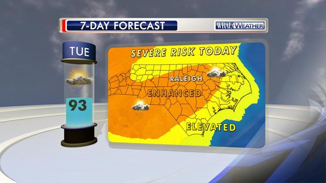
High winds and the threat of hail won't hit until later Tuesday evening, if at all, in the Triangle, WRAL meteorologist Mike Maze said.
Posted — Updated"We're watching a cluster of storms over Ohio," Maze said at about 4:30 p.m., "But we're not sure they will sustain their energy as they move in from the northwest."
Any storms that form across central North Carolina would likely not do so until after 9 p.m., Maze said.
"We're looking at the greatest threat between about 9 p.m. and 2 a.m.," he said.
The Storm Prediction Center downgraded the threat to the Triangle from "enhanced" to simply "elevated."
Storms pushed into the northwestern corner of the state early Tuesday morning, but many of them fizzled out before reaching the Triangle. That pattern could repeat later in the evening, Maze said, but much about the intensity of any storms remained up in the air.
Storms that do form could pack damaging straight-line winds, hail, heavy rain and, possibly, an isolated tornado.
The chance for rain and storms goes down significantly for Wednesday as highs back down into the upper 80s, and even more pleasant conditions will arrive on Thursday.
• Credits
Copyright 2024 by Capitol Broadcasting Company. All rights reserved. This material may not be published, broadcast, rewritten or redistributed.


